

- Usage in publication:
-
- Van Buren formation
- Modifications:
-
- Revised
- AAPG geologic province:
-
- Ozark uplift
Summary:
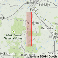
Pg. 137. Van Buren formation. Does not outcrop in immediate vicinity of town of Van Buren [Carter County], which is built on Eminence formation. Nearest exposures are on tops of nearby hills, and no good sections are known anywhere in vicinity. But since name has appeared in print it does not seem wise to attempt to substitute another.
Source: US geologic names lexicon (USGS Bull. 896, p. 2230-2231).
- Usage in publication:
-
- Van Buren formation
- Modifications:
-
- Original reference
- Dominant lithology:
-
- Dolomite
- AAPG geologic province:
-
- Ozark uplift
Summary:
Van Buren formation. The name Gasconade has been applied to the cherty dolomite beds lying between Gunter sandstone member at base and overlying Roubidoux formation. Ulrich believes, however, that two formations occupy this interval, and for upper part he has retained name Gasconade formation, but for lower part he has proposed Van Buren. In recent field work Bridge (Geol. of Eminence-Cardareva quadrangles, Missouri Bur. Geol. and Mines, 2nd ser., vol. in prep.) has used Van Buren to designate a faunal member lying above Gunter sandstone member and a well-defined oolite bed in the Gasconade. Subsurface studies by writer indicate that the Missouri formations may be distinguished on basis of their insoluble residues, and in this paper they are described separately. Base of Van Buren formation is marked by a sandstone member. Ulrich believes this sandstone is older than true Gunter and for that reason has proposed for it the name Van Buren sandstone. The present study would indicate, however, that the sandstone is traceable in drilling over wide areas. As it occupies stratigraphic position of Gunter member, that name is retained in this paper. This sandstone is absent at many localities, but in southern part of State it has a known thickness of at least 60 feet. Locally it contains large amount of dolomite. The Van Buren consists of dolomite, finely crystalline, dark bluish-gray, often granular, with white dense porcelainlike and oolitic chert. Thickness of beds above Gunter sandstone restricted and unconformably underlain by Proctor dolomite, from which it is distinguished, in absence of Gunter sandstone member, by fact that the Van Buren is cherty and the Proctor is noncherty. The character of the chert in the Van Buren is such that it can also be distinguished from overlying cherty Gasconade formation restricted. The dolocastic chert is found only in lower 50 to 75 feet of the Van Buren. The Van Buren contains siliceous oolite and oolitic chert in abundance. Above the dolocastic chert member the chert is more translucent, while below it the chert is denser and marked by quartz veinlets and incrustations. The Gasconade chert is much darker than any similar material in Van Buren or Eminence. Age is Early Ordovician (Beekmantown).
Source: US geologic names lexicon (USGS Bull. 896, p. 2230-2231).

- Usage in publication:
-
- Van Buren formation
- Modifications:
-
- Not used
- AAPG geologic province:
-
- Ozark uplift
Summary:
Pg. 55-56. Basal zone of Gasconade is the Gunter. It is overlain by 80 to 125 feet of thin- to medium-bedded cherty dolomite which, in some Missouri Survey reports, is referred to as Van Buren formation, and this in turn is overlain by massively bedded, cherty dolomite 140 to 200 feet thick. In reports in which term Van Buren is used, term Gasconade is restricted to the upper cherty dolomite. In this report, Gasconade is used in unrestricted sense to include all strata between Eminence and Roubidoux.
Source: US geologic names lexicon (USGS Bull. 1200, p. 4052).

- Usage in publication:
-
- Van Buren
- Modifications:
-
- Not used
- AAPG geologic province:
-
- Ozark uplift
Summary:
Pg. 57. Gunter sandstone is considered member at base of Gasconade. Term Van Buren not used in Missouri.
Source: US geologic names lexicon (USGS Bull. 1200, p. 4052).
- Usage in publication:
-
- Van Buren member
- Modifications:
-
- Overview
- AAPG geologic province:
-
- Ozark uplift
Summary:
Chart 2 (column 52). Shown on correlation chart as member of Gasconade dolomite.
Source: US geologic names lexicon (USGS Bull. 1200, p. 4052).
- Usage in publication:
-
- Van Buren Formation
- Modifications:
-
- Not used
- AAPG geologic province:
-
- Ozark uplift
Summary:
(Paleozoic Era; [Cambrian through Mississippian Systems] by E.D. Goebel, p. 13.) Moore and others (1951, Kansas Geol. Survey Bull., no. 89, p. 119) treated the Gasconade Dolomite and underlying Van Buren Formation as a unit. Earlier, McQueen (1931, p. 18) differentiated the formations in Missouri by means of insoluble residues. Because the formations are difficult to separate in the subsurface far removed from outcrops, Keroher and Kirby (1948, Kansas Geol. Survey Bull., no. 72, 140 p.) designated the sequence in Kansas as /Van Buren-Gasconade. The Missouri Geological Survey (Martin and others, 1961, Missouri Geol. Survey and Water Res., 2nd ser., v. 40, p. 20-32) no longer recognizes the Van Buren and includes the rock sequence from the top of the Eminence Dolomite to the base of the Roubidoux Formation in the Gasconade Dolomite. This practice is now followed in Kansas also.
Source: Publication.

- Usage in publication:
-
- Van Buren formation
- Modifications:
-
- Not used
- AAPG geologic province:
-
- Ozark uplift
Summary:
Pg. 300. The Van Buren was first distinguished and named by Ulrich (1922) [abs., with discussion by J.J. Galloway and A.F. Foerste, GSA Bull., v. 33, p. 112.], but the name was not published until 1931 (McQueen). The name is taken from Van Buren, in Carter County, Missouri, near which the formation is exposed although the town is built on an outcrop of Eminence. It constitutes the lower part of the Gasconade Dolomite as it is now defined; the Gunter Sandstone was included at the base of the Van Buren. The term is not formally used today, although it can be used informally in subsurface studies as a chert-free lower Gasconade unit. The "Van Buren" is generally a low-chert, finely crystalline dolomite similar to the "upper" Gasconade. Age is Ordovician (Ibexian).
Source: Publication.
For more information, please contact Nancy Stamm, Geologic Names Committee Secretary.
Asterisk (*) indicates published by U.S. Geological Survey authors.
"No current usage" (†) implies that a name has been abandoned or has fallen into disuse. Former usage and, if known, replacement name given in parentheses ( ).
Slash (/) indicates name conflicts with nomenclatural guidelines (CSN, 1933; ACSN, 1961, 1970; NACSN, 1983, 2005, 2021). May be explained within brackets ([ ]).