

- Usage in publication:
-
- Vamoosa formation
- Modifications:
-
- Named
- Dominant lithology:
-
- Shale
- Conglomerate
- Sandstone
- AAPG geologic province:
-
- Arkoma basin
- Chautauqua platform
Summary:
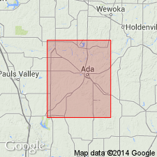
Named after village of Vamoosa, northern part of Stonewall quad, Seminole Co, OK, which is 1/2 mi west of outcrop. No type locality designated. In Stonewall quad, is exposed over approximately 20 sq mi. From northern edge of quad (Seminole Co, Chautauqua platform) outcrop trends in a southwesterly direction to an area 1/2 mi east of Byng. South of Byng (Pontotoc Co, Arkoma basin) is exposed on what is believed to be an outlier. Where all of formation is exposed, average thickness is 260 ft. Consist of (ascending): 30 ft of dark shale (probably fossiliferous, though no collections made); main mass of formation, which includes 260 ft of chert conglomerates, and massive, coarse, red and brown sandstones, and red shales. Clastic material finer near top and red coloration less pronounced near top. Vamoosa contains greater thickness of chert conglomerate than any other formation in the area. Chert fragments which make up the conglomerates are mostly angular; range in size from a fraction of an inch to 3 inches. Overlap of Vamoosa, by succeeding Ada formation (new), is progressive southward. For this reason, only the lower shale and about 30 ft of the clastic portion are exposed near Byng. Overlies Belle City limestone (new). No fossils were found, nor is it probable that any are present in the clastic beds of the unit. Pennsylvanian age. Generalized columnar section. Geologic map.
Source: GNU records (USGS DDS-6; Denver GNULEX).
- Usage in publication:
-
- Vamoosa formation
- Modifications:
-
- Contact revised
- AAPG geologic province:
-
- Chautauqua platform
Summary:
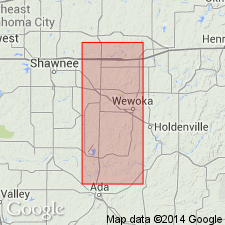
Lower contact revised in that Vamoosa formation, basal formation of Virgil series, unconformably overlies the newly named Hilltop formation, upper formation of the Missouri series. Is one of three formations assigned to Virgil series in this area. History of usage described. Cross sections. Stratigraphic column diagram. Mapped (geologic map) in a north-south belt along east side of map, Seminole Co., OK on the Chautauqua platform. Twelve units in Vamoosa mapped. Each map unit has a basal coarse clastic ledge and an overlying shale. Forms cuestas and scarps. Consists of shale, sandstone, siltstone, and chert conglomerate. Coarsest conglomerates occur in middle part of formation. The sandstones and siltstones are buff to brown, cross-bedded and contorted. The shales are red, brown and orange. Is 125 ft thick at the Canadian River and 550+ ft thick at the North Canadian River. In subsurface to west, thickens to 1,000+ ft. Overlain unconformably by the Ada formation of the Virgil series. Fossils (pelecypods, plant fossils) found in Seminole Co. Considered to be early Virgil in age.
Source: GNU records (USGS DDS-6; Denver GNULEX).
For more information, please contact Nancy Stamm, Geologic Names Committee Secretary.
Asterisk (*) indicates published by U.S. Geological Survey authors.
"No current usage" (†) implies that a name has been abandoned or has fallen into disuse. Former usage and, if known, replacement name given in parentheses ( ).
Slash (/) indicates name conflicts with nomenclatural guidelines (CSN, 1933; ACSN, 1961, 1970; NACSN, 1983, 2005, 2021). May be explained within brackets ([ ]).