The National Geologic Map Database is migrating to a new infrastructure. We apologize for any service disruptions during this process.
|
|---|


- Usage in publication:
-
- Valdes [later Valdez] series*
- Modifications:
-
- Named
- Dominant lithology:
-
- Quartzite
- Arkose
- Schist
- Shale
- Slate
- Conglomerate
- AAPG geologic province:
-
- Alaska Southern region
Summary:
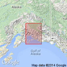
Named for Port Valdes [Valdez] where series is best exposed in southern AK. Extends northward over mountains and down into Copper River Basin and Lake Klutena [Klutina] region. Also extends eastward across Copper from below Tasnuna up near foot of Wood Canyon below Taral. Consists of bluish-gray and dark quartzites, arkoses, and quartz-schists, interbedded with generally thin beds of dark-blue or black slate, shale, mica-schist and some stretched conglomerate. Thickness is probably very great. Overlies Klutena [Klutina] series (new). May be continuation of Orca series (new) but is more highly metamorphosed. Lithology suggests Devonian or Carboniferous age but series may be Cretaceous or early Tertiary.
Source: GNU records (USGS DDS-6; Menlo GNULEX).
- Usage in publication:
-
- Valdez group*
- Modifications:
-
- Redescribed
- Age modified
- Areal extent
- AAPG geologic province:
-
- Alaska Southern region
Summary:
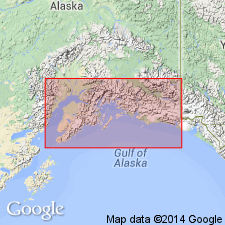
Valdes series of Schrader (1900) redescribed as Valdez Group which unconformably underlies Orca group in which fossils of probable Early Jurassic age have been found. Valdez group should be referred to Paleozoic. Term Sunrise "series" described by Mendenhall (1900) in western part of Prince William Sound are here mapped as Valdez group.
Source: GNU records (USGS DDS-6; Menlo GNULEX).
- Usage in publication:
-
- Valdez Group*
- Modifications:
-
- Age modified
- Biostratigraphic dating
- Areal extent
- AAPG geologic province:
-
- Alaska Southern region
Summary:
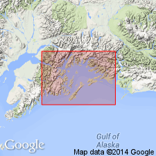
Type area designated as Port Valdez, southern AK. Geographically extended into strata north of Turnagain Arm [questionably extended by previous workers]. Valdez Group was traced eastward to Canadian border, northward to Border Ranges fault and southward to Contact fault system. Age is Late Cretaceous based on fossils of Maestrichtian and possibly Campanian Age. Fossil localities are shown on sketch map.
Source: GNU records (USGS DDS-6; Menlo GNULEX).
For more information, please contact Nancy Stamm, Geologic Names Committee Secretary.
Asterisk (*) indicates published by U.S. Geological Survey authors.
"No current usage" (†) implies that a name has been abandoned or has fallen into disuse. Former usage and, if known, replacement name given in parentheses ( ).
Slash (/) indicates name conflicts with nomenclatural guidelines (CSN, 1933; ACSN, 1961, 1970; NACSN, 1983, 2005, 2021). May be explained within brackets ([ ]).