

- Usage in publication:
-
- Uvas basalt, basaltic andesite
- Modifications:
-
- First used
- Dominant lithology:
-
- Basalt
- Andesite
- Tuff
- AAPG geologic province:
-
- Orogrande basin
Summary:
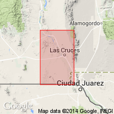
First published use of name. Intent to name not stated; no type locality designated. Crops out along the Rio Grande Valley, and in Dona Ana, Robledo, and Picacho Mountains, Dona Ana Co, NM, Orogrande basin. Overlies Bell Top formation (new); overlain by lower beds of Santa Fe formation. Consists of flows of basalt/basaltic andesite with interbedded scoria and basaltic tuffs, as much as 145 ft thick. Uvas basalt caps Bell Top formation southwest of Hatch, but near Palm Park similar flows are interbedded with upper strata of Thurman formation. Uvas basalt is absent north and east of Selden Canyon, but pebbles and boulders derived from it are abundant in the younger clastic beds. Shown on stratigraphic chart as Miocene age.
Source: GNU records (USGS DDS-6; Denver GNULEX).
For more information, please contact Nancy Stamm, Geologic Names Committee Secretary.
Asterisk (*) indicates published by U.S. Geological Survey authors.
"No current usage" (†) implies that a name has been abandoned or has fallen into disuse. Former usage and, if known, replacement name given in parentheses ( ).
Slash (/) indicates name conflicts with nomenclatural guidelines (CSN, 1933; ACSN, 1961, 1970; NACSN, 1983, 2005, 2021). May be explained within brackets ([ ]).