The National Geologic Map Database is migrating to a new infrastructure. We apologize for any service disruptions during this process.
|
|---|


- Usage in publication:
-
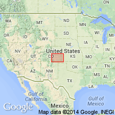
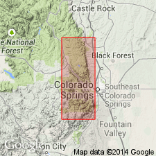
- Ute Pass dolomite*
- Modifications:
-
- Named
- Dominant lithology:
-
- Dolomite
- AAPG geologic province:
-
- Denver basin
Summary:
Named Ute Pass dolomite for outcrops in the Ute Pass area, Douglas and El Paso Cos, CO of the Denver basin. No type locality designated. Section 14 ft 2 in thick measured in Williams Canyon NW1/4 sec 32, T13S, R67W, El Paso Co. Composed of dark-red, purple-red to buff, granular to coarsely crystalline dolomite. Lowest dolomite is very glauconitic. Is 14 ft 2 in thick in Williams Canyon, near Manitou Springs; varies from 8 1/2 to 16 ft in thickness. Rests gradationally on Sawatch sandstone; is identical to Bonneterre dolomite of the subsurface of eastern CO and western KS; underlies Manitou limestone, restricted. Was part of Manitou limestone of Cross (1894) but is removed from Manitou in this report because in the absence of fossils it is considered...to be Upper Cambrian... Designated Late? Cambrian in report. Cross sections.
Source: GNU records (USGS DDS-6; Denver GNULEX).
- Usage in publication:
-
- Ute Pass dolomite*†
- Modifications:
-
- Abandoned
Summary:
The 14 ft of strata removed from the Manitou limestone and assigned to Ute Pass dolomite by Maher (1950) at Williams Canyon, T13S, R67W, El Paso Co, CO in the Denver basin, is reassigned to the lower part of the Manitou. These 14 ft of strata are of Early Ordovician age, belonging to zone D of the Ordovician and they are lithologically comparable to rocks assigned to Manitou at other locations. Rocks at Missouri Gulch that were assigned to the Ute Pass are Peerless formation on basis of lithology and stratigraphic position. Name Ute Pass dolomite, therefore, abandoned. Cross section.
Source: GNU records (USGS DDS-6; Denver GNULEX).
For more information, please contact Nancy Stamm, Geologic Names Committee Secretary.
Asterisk (*) indicates published by U.S. Geological Survey authors.
"No current usage" (†) implies that a name has been abandoned or has fallen into disuse. Former usage and, if known, replacement name given in parentheses ( ).
Slash (/) indicates name conflicts with nomenclatural guidelines (CSN, 1933; ACSN, 1961, 1970; NACSN, 1983, 2005, 2021). May be explained within brackets ([ ]).