- Usage in publication:
-
- Upson clays
- Modifications:
-
- First used
- Dominant lithology:
-
- Clay
- Shale
- AAPG geologic province:
-
- Gulf Coast basin
Summary:
First used as basal member of four in the Eagle Pass division (revised) as exposed just below the mouth of Las Moras creek, Maverick Co, TX (Gulf Coast basin). Type not designated; derivation of name not stated. Overlies Pinto limestone (new). Overlain by San Miguel beds (new) of Eagle Pass division. Consists of yellow clay containing calcareous nodules of septarian character, the crevices or septae of which are filled with dogtooth spar; nodules occur in large geodic forms scattered through the clays, and contain EXOGYRA PONDEROSA; numbers of these fossils are found in geodes as well as on the hillsides, where they have been left by disintegration of their matrix; nodules or geodes seem to occupy definite horizons, and sometimes form benches on the hillsides; uppermost part observed is a clay shale. Thickness based on apparent dip is 700 ft. Correlated with Ponderosa marls of the Colorado River section. Age is Late Cretaceous.
Source: GNU records (USGS DDS-6; Denver GNULEX).

- Usage in publication:
-
- Upson Clay
- Modifications:
-
- Mapped 1:250k
- Dominant lithology:
-
- Clay
- AAPG geologic province:
-
- Gulf Coast basin
Summary:
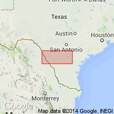
Upson Clay. [Clay.] Slightly calcareous, dark gray to greenish gray; weathers yellowish gray; marine megafossils include EXOGYRA PONDEROSA. Thickness up to about 500 feet, thins rapidly northward. Lies above Austin Chalk and below San Miguel Formation. Age is Late Cretaceous.
[Mapped in north-central and northwestern Maverick Co., southwestern TX.]
Source: Publication.

- Usage in publication:
-
- Upson Clay
- Modifications:
-
- Areal extent
- Mapped 1:250k
- AAPG geologic province:
-
- Ouachita folded belt
- Gulf Coast basin
Summary:
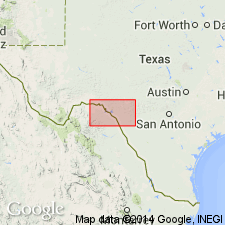
Is Upper Cretaceous formation mapped in southeastern Kinney Co, TX (Ouachita tectonic belt province) and northeastern Maverick Co, TX (Gulf Coast basin). Overlies Austin Chalk; underlies San Miguel Formation in southwestern part of outcrop belt, and underlies Anacacho Limestone eastward as Upson feathers out. Map unit described as slightly calcareous, dark gray to greenish gray; weathers yellowish gray; marine megafossils include EXOGYRA PONDEROSA; thickness about 500 ft, feathers out eastward, lowest part of Taylor Group.
Source: GNU records (USGS DDS-6; Denver GNULEX).
For more information, please contact Nancy Stamm, Geologic Names Committee Secretary.
Asterisk (*) indicates published by U.S. Geological Survey authors.
"No current usage" (†) implies that a name has been abandoned or has fallen into disuse. Former usage and, if known, replacement name given in parentheses ( ).
Slash (/) indicates name conflicts with nomenclatural guidelines (CSN, 1933; ACSN, 1961, 1970; NACSN, 1983, 2005, 2021). May be explained within brackets ([ ]).

