- Usage in publication:
-
- Upland Gravel
- Modifications:
-
- Named
- Dominant lithology:
-
- Gravel
- AAPG geologic province:
-
- Atlantic Coast basin
Summary:
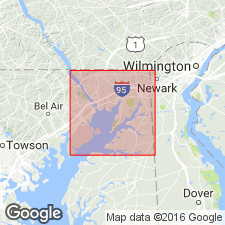
Bryn Mawr, Brandywine, and Sunderland gravels here referred to collectively as Upland Gravel (after Cleaves and others, 1968: Geologic map of MD; and Owens, 1969). Was mapped as "Gravel of High Plateau" by Darton (1939). Talbot Formation is retained as a separate unit. Upland is treated here as a single deposit but may actually represent two generations of deposition. Most of the Upland in study area is concentrated in western part of Cecil Co. within 6 or 8 mi of the present course of the Susquehanna River. At most places overlies the Potomac Group, but to the north overlies saprolite of crystalline rocks. Just north of Rte 40, base of gravel lies at about 300 ft, but further north, gravel lies at 400 ft and thickness ranges to 75 ft. Unit consists primarily of gravel and varying amounts of sand with a little clay. Gravel is composed almost entirely of quartz and quartzite clasts, but also contains a few chert pebbles. Unconformably underlies Pensauken Formation (previously mapped in this area as Wicomico). The Upland is here considered to be of probable Miocene age. [This manuscript was reviewed by the GNU in 1973, but was not published until 1990. There is no record of this particular unit in the GNU files from that review, and it is assumed that this section of manuscript was added or altered post-review. Therefore, the Upland Gravel is not considered formal USGS usage.]
Source: GNU records (USGS DDS-6; Reston GNULEX).
For more information, please contact Nancy Stamm, Geologic Names Committee Secretary.
Asterisk (*) indicates published by U.S. Geological Survey authors.
"No current usage" (†) implies that a name has been abandoned or has fallen into disuse. Former usage and, if known, replacement name given in parentheses ( ).
Slash (/) indicates name conflicts with nomenclatural guidelines (CSN, 1933; ACSN, 1961, 1970; NACSN, 1983, 2005, 2021). May be explained within brackets ([ ]).

