

- Usage in publication:
-
- University beds
- Modifications:
-
- Named
- Dominant lithology:
-
- Clay
- AAPG geologic province:
-
- Estancia basin
Summary:
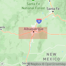
In valley of the Rio Grande, Albuquerque quad, Bernalillo Co, NM in Estancia basin, in side gulches of second canyon of the river were deposited a series of side-wash deposits here named University beds. They form a considerable part of Sandia Mesa within this area, extending south from Menaul School Arroyo to Powder House Arroyo, and in a wedge-shape to east. No type locality designated. Deposits are reddish, sandy clays, frequently cross bedded, showing many minor unconformities, and containing large, angular boulders of Sandia Mountains material; they are without doubt frontal apron wash. The well section at the University [in Albuquerque?] shows that they have a depth there of 95 ft. These beds were deposited by a lateral [stream] from the Sandia Mountains during the deposition of the Rio Grande gravels; probably from Tijeras stream, which probably made a deep cut over the area during the second cut of the river and there deposited the beds coincident in time with Rio Grande gravels. On west bank of the Rio Grande River in the Adobe Cliffs is a similar deposit lying unconformably on the Rio Grande beds. This is a sandy clay not well sorted and showing along the contact line that the Rio Grande beds contributed largely to the clay's composition. This sandy clay was deposited by small tributaries similar to the large tributary on east of river, and is included under name University. Is of Quaternary age. Geologic map.
Source: GNU records (USGS DDS-6; Denver GNULEX).
For more information, please contact Nancy Stamm, Geologic Names Committee Secretary.
Asterisk (*) indicates published by U.S. Geological Survey authors.
"No current usage" (†) implies that a name has been abandoned or has fallen into disuse. Former usage and, if known, replacement name given in parentheses ( ).
Slash (/) indicates name conflicts with nomenclatural guidelines (CSN, 1933; ACSN, 1961, 1970; NACSN, 1983, 2005, 2021). May be explained within brackets ([ ]).