The National Geologic Map Database is migrating to a new infrastructure. We apologize for any service disruptions during this process.
|
|---|


- Usage in publication:
-
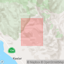
- Union Wash Formation
- Modifications:
-
- Named
- Biostratigraphic dating
- Dominant lithology:
-
- Shale
- Limestone
- AAPG geologic province:
-
- Great Basin province
Summary:
Named for Union Wash in Inyo Mountains. Type locality designated as exposures on south side of Union Wash [east of Lone Pine road in northeastern part of Union Wash 7.5' quad, Inyo Co, CA]. Type locality contains type localities of large ammonoid fauna. Fossiliferous rocks of unit referred to by Smith (1898) as Ceratite limestone. Consists mainly of gray to dark brown fissile and platy shale and calcareous shale, platy thinly bedded limestone, argillaceous limestone, and occasional lenticular beds of massive gray limestone. Is approximately 2500 feet thick. Disconformably overlies Owens Valley Formation. Conformably underlies unnamed volcanics, breccias, conglomerates, and tuffs. Age is Early Triassic to later Middle Triassic based on ammonoid cephalopods (including PARAPOPANOCERAS fauna) and on conodonts.
Source: GNU records (USGS DDS-6; Menlo GNULEX).
- Usage in publication:
-
- Union Wash Formation*
- Modifications:
-
- Adopted
- Biostratigraphic dating
Summary:
Union Wash Formation of Mount (1971) adopted. Type section 1s designated as south side of Union Wash area in T14S R36E, Union Wash 7.5 quad, Inyo Co, CA. Exposed in Inyo Mountains, Darwin area, and Argus Range (Bendire and Water Canyon areas). Consists of three informal members; total thickness ranges from 700 to 900 m. Lower member, generally less than 50 m thick, consists of silty and sandy limestone. Middle member, thickness approximately 250 to 800 m, consists of thin-bedded siliceous mudstone, calcareous mudstone, and micritic limestone. Upper member, maximum thickness 450 m, consists of thin-bedded to massive micritic limestone, silty to sandy limestone, shale, and quartzose siltstone and very fine-grained sandstone. Unconformably underlain locally by Permian sedimentary rocks assigned to the Owens Valley Group and Keeler Canyon Formation. Unconformably overlain by unnamed volcanic and sedimentary rocks of Triassic and (or) Jurassic age. Unit age is Early (Smithian) and Middle(?) (latest Spathian and possibly Anisian) Triassic based on conodonts and ammonites.
Source: GNU records (USGS DDS-6; Menlo GNULEX).
For more information, please contact Nancy Stamm, Geologic Names Committee Secretary.
Asterisk (*) indicates published by U.S. Geological Survey authors.
"No current usage" (†) implies that a name has been abandoned or has fallen into disuse. Former usage and, if known, replacement name given in parentheses ( ).
Slash (/) indicates name conflicts with nomenclatural guidelines (CSN, 1933; ACSN, 1961, 1970; NACSN, 1983, 2005, 2021). May be explained within brackets ([ ]).