The National Geologic Map Database is migrating to a new infrastructure. We apologize for any service disruptions during this process.
|
|---|


- Usage in publication:
-
- Union Valley formation
- Modifications:
-
- Revised
- AAPG geologic province:
-
- Ouachita folded belt
Summary:
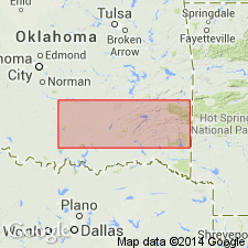
Revised as basal formation of Springer group of Morrow series of the Bendian period. Formerly called Union Valley sandstone. Is a very widespread deposit and sandstones in most areas make up ridges of moderate relief. Found in east-central OK immediately south of Choctaw fault from vicinity of Limestone Gap to AR State line. "Typical exposure" is in the Ouachita Mountains in sec 36, T1S, R12E, Atoka Co; here it consists of gray to dark-gray shale and intercalated massive and thin-bedded greenish-yellow, limonitic, fine to medium subangular sandstone. Commonly case-hardened by silica. Thickness is uniform and about 360 ft at most places in the Ouachita Mountains. Includes Stapp conglomerate member (new) at base. In the southern Ouachitas, underlies Round Prairie formation (new) of Morrow series of Bendian period; in frontal Ouachitas and north of Arbuckles, underlies Primrose formation; both of these formations are of Springer group of Morrow series of the Bendian period. Unconformably overlies Wesley shale (new) of Jackfork group (raised in rank) of Pushmataha series (new) of Bendian, in the southern and frontal Ouachitas; unconformably overlies Wesley shale north of Arbuckles. Correlation chart. Fossil list (calamites, crinoids, mollusks). Carboniferous age.
Source: GNU records (USGS DDS-6; Denver GNULEX).
For more information, please contact Nancy Stamm, Geologic Names Committee Secretary.
Asterisk (*) indicates published by U.S. Geological Survey authors.
"No current usage" (†) implies that a name has been abandoned or has fallen into disuse. Former usage and, if known, replacement name given in parentheses ( ).
Slash (/) indicates name conflicts with nomenclatural guidelines (CSN, 1933; ACSN, 1961, 1970; NACSN, 1983, 2005, 2021). May be explained within brackets ([ ]).