

- Usage in publication:
-
- Union Dairy member
- Modifications:
-
- Named
- Dominant lithology:
-
- Sandstone
- Limestone
- Shale
- AAPG geologic province:
-
- South Oklahoma folded belt
Summary:
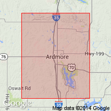
Named as a member of Hoxbar formation (raised in rank); named from Union Dairy Hill in NE1/4 sec 7, T5S, R2E, Carter Co, OK in the S. Oklahoma folded belt province. No specific type locality designated. Occurs in the Ardmore basin of southern OK. Consists of a basal buff sandstone from 5 to 20 ft thick; an interval of 20 or 30 ft of calcareous shale; and about 25 ft of gray to cream-colored limestone at the top which varies from earthy to finely crystalline and even coarsely crystalline. The limestone locally carries abundant FUSULINAS, pelecypods, brachiopods, etc. Lies some 400 ft above the Confederate limestone member (new) of the Hoxbar; lies some 800 ft below Westheimer member (new) of the Hoxbar. Fossil list; geologic map; columnar section. Of Pennsylvanian age.
Source: GNU records (USGS DDS-6; Denver GNULEX).
For more information, please contact Nancy Stamm, Geologic Names Committee Secretary.
Asterisk (*) indicates published by U.S. Geological Survey authors.
"No current usage" (†) implies that a name has been abandoned or has fallen into disuse. Former usage and, if known, replacement name given in parentheses ( ).
Slash (/) indicates name conflicts with nomenclatural guidelines (CSN, 1933; ACSN, 1961, 1970; NACSN, 1983, 2005, 2021). May be explained within brackets ([ ]).