

- Usage in publication:
-
- Underwood formation
- Modifications:
-
- Named
- Dominant lithology:
-
- Shale
- AAPG geologic province:
-
- Cincinnati arch
Summary:
Name Underwood formation proposed in this report for a 6-in. soft greenish fossiliferous shale with a layer of phosphatic nodules at top occurring east of Underwood, Clark Co., southeastern IN. Lies between Falling Run member of Sanderson formation and Henryville shale (all new).
Source: GNU records (USGS DDS-6; Reston GNULEX).
- Usage in publication:
-
- Underwood member
- Modifications:
-
- Revised
- AAPG geologic province:
-
- Cincinnati arch
Summary:
Mississippian part of New Albany has been divided into (ascending) Sanderson, Underwood, and Henryville members according to the usage of the Indiana Geological Survey.
Source: GNU records (USGS DDS-6; Reston GNULEX).
- Usage in publication:
-
- Underwood Bed
- Modifications:
-
- Revised
- AAPG geologic province:
-
- Cincinnati arch
Summary:
Clegg Creek Member of the New Albany Shale is formally proposed in this report in southern IN. The Clegg Creek includes the Falling Run, Underwood, Henryville, and Jacobs Chapel Beds. Age of the Underwood in this report is Late Devonian.
Source: GNU records (USGS DDS-6; Reston GNULEX).
- Usage in publication:
-
- Underwood Formation
- Modifications:
-
- Revised
- AAPG geologic province:
-
- Cincinnati arch
Summary:
According to the authors, the Falling Run, Underwood, and Henryville Formations are coeval facies and are not part of the New Albany. The Underwood overlies the Sanderson Formation of the New Albany and underlies the Jacobs Chapel Shale or Rockford Limestone. Occurs in southern IN and southwestern KY according to Appendix A. Age is Early Mississippian.
Source: GNU records (USGS DDS-6; Reston GNULEX).
- Usage in publication:
-
- Underwood Bed
- Modifications:
-
- Areal extent
- Overview
- AAPG geologic province:
-
- Cincinnati arch
Summary:
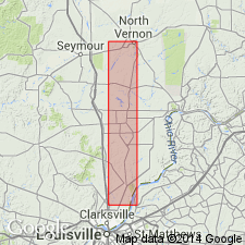
Underwood Bed of Clegg Creek Member of New Albany Shale is recognized only in the immediate vicinity of its type locality near Underwood, Clark Co., IN. It overlies the Falling Run Bed and underlies the Henryville Bed. Consists of fossiliferous, greenish-gray shale and is 0.4 ft thick. Contains a conodont and scolecodont fauna of Kinderhookian age. Correlates with the lower part of the Hannibal Shale of MO and IL.
Source: GNU records (USGS DDS-6; Reston GNULEX).
For more information, please contact Nancy Stamm, Geologic Names Committee Secretary.
Asterisk (*) indicates published by U.S. Geological Survey authors.
"No current usage" (†) implies that a name has been abandoned or has fallen into disuse. Former usage and, if known, replacement name given in parentheses ( ).
Slash (/) indicates name conflicts with nomenclatural guidelines (CSN, 1933; ACSN, 1961, 1970; NACSN, 1983, 2005, 2021). May be explained within brackets ([ ]).