

- Usage in publication:
-
- Unalaska formation*
- Modifications:
-
- Named
- Biostratigraphic dating
- Dominant lithology:
-
- Pyroclastics
- Volcanics
- AAPG geologic province:
-
- Aleutian Islands province
- Alaska Southwestern region
Summary:
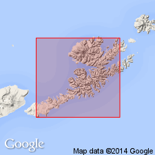
Named for oldest exposures on Unalaska Island, Aleutian Islands, AK. Exposed over two-thirds of island. Is thick sequence of coarse and fine sedimentary and pyroclastic rocks, intercalated with dacitic, andesitic, and basaltic flows and sills. Cut by numerous dikes and small plutons. Typical measured section described west of Hive Bay. Topographic relief indicates minimum thickness of 3000 ft; maximum of 55,000 ft calculated from regional dip of rocks to 15 deg NNW. Unconformably underlies Makushin volcanics (new). Age is early Miocene and older based on fossils identified by F.S. MacNeil and G.E. Lewis and probable age of nonfossiliferous volcanic rocks in unit. Rocks formerly mapped as Mesozoic(?) but this was before discovery of desmostylid teeth.
Source: GNU records (USGS DDS-6; Menlo GNULEX).
- Usage in publication:
-
- Unalaska Formation*
- Modifications:
-
- Revised
- AAPG geologic province:
-
- Alaska Southwestern region
- Aleutian Islands province
Summary:
Unalaska Formation is divided into: lower volcanic sequence, Dutch Harbor Member (new), and upper volcanic sequence.
Source: GNU records (USGS DDS-6; Menlo GNULEX).
For more information, please contact Nancy Stamm, Geologic Names Committee Secretary.
Asterisk (*) indicates published by U.S. Geological Survey authors.
"No current usage" (†) implies that a name has been abandoned or has fallen into disuse. Former usage and, if known, replacement name given in parentheses ( ).
Slash (/) indicates name conflicts with nomenclatural guidelines (CSN, 1933; ACSN, 1961, 1970; NACSN, 1983, 2005, 2021). May be explained within brackets ([ ]).