The National Geologic Map Database is migrating to a new infrastructure. We apologize for any service disruptions during this process.
|
|---|


- Usage in publication:
-
- Umiat formation
- Modifications:
-
- Named
- Biostratigraphic dating
- Dominant lithology:
-
- Sandstone
- Shale
- AAPG geologic province:
-
- Alaska Northern region
Summary:
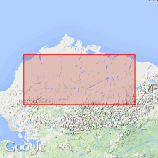
Umiat formation. Is marine formation in Nanushuk group, which also contains nonmarine formation, Chandler formation (new). Divided into (ascending) Tuktu and Topagoruk members (both new). Umiat intertongues with Chandler formation to the south. Inshore facies consists of relatively clean sandstone that grades northeast through argillaceous sandstone into shale of offshore facies. Thickness is about 5000 feet. Overlies Torok formation (new); lower part (Tuktu member) is marine shale similar to shale of Torok. Underlies Schrader Bluff formation (new). Age of lower part is Early Cretaceous (middle Albian) age, based on scarce mollusks and arenaceous foraminifers. Age of upper part is probably also Early(?) Cretaceous (late Albian) age, but fossil data is inconclusive.
Named from marine part of section below 750 ft in Umiat Test Well No.1, in vicinity of Umiat, Colville River region, northern AK.
Source: Modified from GNU records (USGS DDS-6; Menlo GNULEX).
- Usage in publication:
-
- Umiat formation
- Modifications:
-
- Age modified
- AAPG geologic province:
-
- Alaska Northern region
Summary:
Umiat formation (marine) of Nanushuk group shown on correlation chart. Age is Early and Late Cretaceous (middle Albian to Cenomanian).
Source: Modified from GNU records (USGS DDS-6; Menlo GNULEX).
- Usage in publication:
-
- Umiat formation†
- Modifications:
-
- Abandoned
- AAPG geologic province:
-
- Alaska Northern region
Summary:
The Umiat formation of Gryc and others (1951) of Nanushuk group is abandoned. Correlation chart shows that rocks of Umiat (of Early and Late Cretaceous age) now called Topagoruk formation and Nanushuk group consisting of Tuktu, Grandstand, Chandler, and Ninuluk formations (described in separate papers following "Introduction...").
Source: GNU records (USGS DDS-6; Menlo GNULEX).
For more information, please contact Nancy Stamm, Geologic Names Committee Secretary.
Asterisk (*) indicates published by U.S. Geological Survey authors.
"No current usage" (†) implies that a name has been abandoned or has fallen into disuse. Former usage and, if known, replacement name given in parentheses ( ).
Slash (/) indicates name conflicts with nomenclatural guidelines (CSN, 1933; ACSN, 1961, 1970; NACSN, 1983, 2005, 2021). May be explained within brackets ([ ]).