- Usage in publication:
-
- Tygee sandstone*
- Modifications:
-
- Original reference
- Dominant lithology:
-
- Sandstone
- AAPG geologic province:
-
- Wasatch uplift
- Central Western Overthrust
Summary:
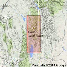
Pg. 76, 83. Tygee sandstone of Gannett group. Gray to buff, even-grained, and without greenish or reddish tinges of some of higher sandstones. Top is not exposed, and in much of region this sandstone, with part or all of underlying Draney limestone, was eroded before deposition of Wayan formation. At type locality about 100 feet of this sandstone is exposed. Is top formation of Gannett Group. Age is Cretaceous(?).
Named from Tygee Creek, east of which, in T. 8 S., R. 46 E., [Sage Valley and Auburn 7.5-min quadrangles, Caribou Co., southeastern ID], the formation is well exposed in association with Draney limestone.
Source: US geologic names lexicon (USGS Bull. 896, p. 2205-2206).
- Usage in publication:
-
- Tygee sandstone
- Modifications:
-
- Mapped
- AAPG geologic province:
-
- Central Western Overthrust
Summary:
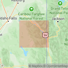
Pg. 26-28. Tygee sandstone of Gannett group. Section measured on Fall Creek, Fall Creek quadrangle [northwest part USGS Irwin quadrangle, scale 1:125,000], Bonneville County, southeastern Idaho, gives thickness of Tygee as 1,020 feet. Overlies Draney limestone, unconformably underlies Wayan formation. Thickness at type locality about 100 feet. Age is Cretaceous.
[See also J.D. Vine, 1959, USGS Bull. 1055-I.]
Source: Publication; US geologic names lexicon (USGS Bull. 1200, p. 4001-4002).
- Usage in publication:
-
- Tygee sandstone
- Modifications:
-
- Not used
- AAPG geologic province:
-
- Central Western Overthrust
Moritz, C.A., 1953, Summary of the Cretaceous stratigraphy of southeastern Idaho and western Wyoming: Intermountain Association of Petroleum Geologists, Guidebook for the Annual Field Conference, no. 4, p. 63-72.
Summary:
Pg. 68. Tygee sandstone. In Fall Creek area, Bonneville County, southeastern Idaho, about 980 feet of Tygee beds are assigned to Bear River formation; section not complete.
Source: Publication; US geologic names lexicon (USGS Bull. 1200, p. 4001-4002).
- Usage in publication:
-
- Tygee sandstone member
- Modifications:
-
- Areal extent
- AAPG geologic province:
-
- Central Western Overthrust
Summary:
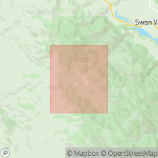
Pg. 53, 56-57, pl. 21. Tygee sandstone member of Gannett group. The uppermost part of Gannett group contains brownish-gray sandy to silty beds with little interbedded red material and less than 3 feet of limestone. This interval is tentatively referred to the Tygee sandstone member. Best displayed on north side of Snake River Canyon along U.S. Highway 89, just below excellent Bear River exposure near Keyser Creek [in sec. 2, T. 37 N., R. 117 W., Pine Creek 7.5-min quadrangle, Lincoln County, Targhee-Bridger National Forest bdry., western Wyoming]. Overlies Dranely limestone member of Gannett group. Underlies Bear River Formation. Age is Early Cretaceous.
Source: Publication; US geologic names lexicon (USGS Bull. 1200, p. 4001-4002).
- Usage in publication:
-
- Tygee sandstone member
- Modifications:
-
- Areal extent
- AAPG geologic province:
-
- Central Western Overthrust
Boeckerman, R.B., and Eardley, A.J., 1956, Geology of southwest Jackson quadrangle, Lincoln County, Wyoming: Wyoming Geological Association Field Conference Guidebook, no. 11, p. 179-183.
Summary:
Pg. 198. Tygee sandstone member of Gannett group. In Jackson Hole country, uppermost member of Gannett group. Consists of brownish-gray siltstone and rust-stained shale. Contains one or more reddish sandstone beds. Thickness 198 feet. Overlies Draney limestone member of Gannett group; unconformably underlies Bear River formation. Age is Early Cretaceous.
Source: US geologic names lexicon (USGS Bull. 1200, p. 4001-4002).
- Usage in publication:
-
- Tygee sandstone*
- Modifications:
-
- Areal extent
- AAPG geologic province:
-
- Central Western Overthrust
Summary:
Pg. I-259 (table), I-261 - I-262. Tygee sandstone of Gannett group. In Bonneville County, Idaho, Tygee sandstone conformably overlies Draney limestone and conformably underlies Bear River formation. Thickness 285 feet where measured on Skyline Ridge. Formation consists of interbedded red shale and gray to brown sandstone. Strata in Skyline Ridge section are overturned and dip 85 deg. NE. The intense deformation may have caused formation to be thinner here than in a normal section. Limits of formation differ greatly from limits described by Kirkham (1924), who included beds in Tygee that are here called Bear River formation. Apparently Kirkham measured his section east of Fall Creek Ranger Station, where faulting has duplicated strata. Age is Early Cretaceous.
Source: US geologic names lexicon (USGS Bull. 1200, p. 4001-4002).
- Usage in publication:
-
- Tygee Member
- Modifications:
-
- [Revised]
- AAPG geologic province:
-
- Central Western Overthrust
Summary:
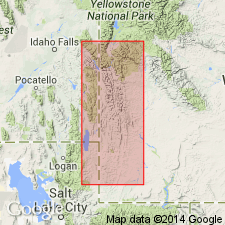
Pg. 1373-1374 (figs. 2, 3), 1387. Tygee Member of Bear River Formation. [Reduced in rank to member of Bear River Formation.] Upper part consists of ridge-forming, medium- to coarse-grained, ripple marked sandstone, up to 150 feet thick (= Tygee of Mansfield and Roundy); lower part consists of black shale, 0 to 260 feet thick. Overlies Smoot Formation (new) of Gannett Group. Age is Early Cretaceous (Albian).
Notable exposures: Fall Creek, Bonneville Co., eastern ID, and Salt River Pass, Thomas Fork Canyon, East Fork, and Turkey Creek, Lincoln Co., western WY; lower shale unit absent south of Evanston, Uinta Co., southwestern WY.
[GNC remark (March 10, 2016): For several years prior to this publication geologists suggested the Tygee Sandstone, assigned to top part of Gannett Group by Mansfield and Roundy and by the USGS, be considered a member of the overlying Bear River Formation, but assigned the rocks to unnamed units either within or between the Gannett and Bear River.]
Source: Publication
- Usage in publication:
-
- Tygee Sandstone†
- Modifications:
-
- Abandoned
- AAPG geologic province:
-
- Green River basin
Summary:
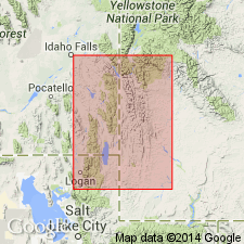
Pg. 16. †Tygee Sandstone of Gannett Group [USGS classification] abandoned. As former upper formation of Gannett Group, Tygee rocks reassigned as unnamed upper sandstone member of Smiths Formation (newly adopted and not part of Gannett Group). [Adopted by the USGS (see Changes in stratigraphic nomenclature, 1974, USGS Bull. 1405-A, p. A22-A23).]
Source: Changes in stratigraphic nomenclature, 1974 (USGS Bull. 1405-A, p. A22-A23).
For more information, please contact Nancy Stamm, Geologic Names Committee Secretary.
Asterisk (*) indicates published by U.S. Geological Survey authors.
"No current usage" (†) implies that a name has been abandoned or has fallen into disuse. Former usage and, if known, replacement name given in parentheses ( ).
Slash (/) indicates name conflicts with nomenclatural guidelines (CSN, 1933; ACSN, 1961, 1970; NACSN, 1983, 2005, 2021). May be explained within brackets ([ ]).

