The National Geologic Map Database is migrating to a new infrastructure. We apologize for any service disruptions during this process.
|
|---|


- Usage in publication:
-
- Twist Gulch member*
- Modifications:
-
- Named
- Dominant lithology:
-
- Siltstone
- Shale
- Sandstone
- AAPG geologic province:
-
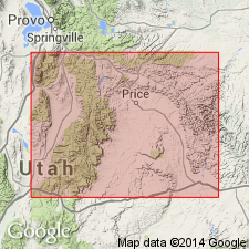
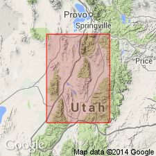
- Wasatch uplift
Summary:
Named as upper member of Arapien shale (new)--also called unit 5 of Arapien--for exposures on north side of Salina Canyon above Twist Gulch, Sevier Co, UT on the Wasatch uplift. No type locality designated. Name applied to the uppermost or the fifth unit of the Arapien. Is about 3,000 ft thick. Consists of red siltstone and shale with many thin layers of greenish-white siltstone and occasional layers of gray sandstone, some of which is coarse grained. Has many thin beds of green-gray to white siltstone. Overlies Twelvemile Canyon member (new) of Arapien gradationally. Underlies Morrison? formation. Is similar to the Summerville formation. Unfossiliferous. Assigned to the Late Jurassic. Stratigraphic table.
Source: GNU records (USGS DDS-6; Denver GNULEX).
- Usage in publication:
-
- Twist Gulch formation
- Modifications:
-
- Revised
- Overview
- AAPG geologic province:
-
- Great Basin province
- Wasatch uplift
Summary:
Raised in stratigraphic rank from Twist Gulch member of Arapien shale to Twist Gulch formation "because of its great areal extent" in UT. Arapien of this report includes "Types" 1 to 4 of Spieker's Twelvemile Canyon member of Arapien. "Type" 5 of Spieker's Twist Gulch member of Arapien is the Twist Gulch formation of this report. Occurs in several areas on the Gunnison Plateau between Nephi and Levan, Juab Co, UT in the Great Basin province, and near Salina Creek in Sevier Co, UT on the Wasatch uplift. Areal extent map. Cross sections. Measured sections. About 3,000 ft thick. Overlies Arapien shale (formerly designated Twelvemile Canyon member of Arapien). Is largely red siltstone and red-gray sandstone, and therefore of more uniform lithology than the underlying Arapien. Is overlain by the Morrison? formation; is locally overlain, an angular unconformity, by the Flagstaff, Colton, and Green River formations. Is unfossiliferous except for upper part in Salina Canyon. Thought to be equivalent to the Entrada, Curtis, Summerville, and Twin Creek (middle part) formations. Assigned to the Late Jurassic.
Source: GNU records (USGS DDS-6; Denver GNULEX).

- Usage in publication:
-
- Twist Gulch Member*
- Modifications:
-
- Overview
- AAPG geologic province:
-
- Great Basin province
- Wasatch uplift
Summary:
Arapien Shale of central UT in the Nephi-Levan area, west side of Gunnison Plateau, Juab Co (Great Basin province) is 5,464 ft thick, and is divisible into Twelvemile Canyon Member (3590 ft thick, at base) of Bajocian, Bathonian, and early Callovian age, and Twist Gulch Member (1874 ft thick, at top) of early and middle Callovian age. In the Gunnison-Salina-Richfield area, Sevier and Sanpete Cos (Wasatch uplift), Arapien represents less of Middle Jurassic time; the Twelvemile Canyon is 1800-2700 ft thick and of late Bathonian and early Callovian age; the overlying Twist Gulch is 1730 ft thick and of early and middle Callovian age. Twelvemile Canyon thought to resemble members of Twin Creek Limestone from base of Gypsum Spring to basal Leeds Creek Member; Twist Gulch thought to be lithologically similar to Preuss Sandstone. Stratigraphic chart. Arapien unconformably overlies Navajo Sandstone. Arapien unconformably underlies Curtis Formation in Gunnison area, and younger rocks elsewhere.
Source: GNU records (USGS DDS-6; Denver GNULEX).
- Usage in publication:
-
- Twist Gulch Formation*
- Modifications:
-
- Revised
- AAPG geologic province:
-
- Wasatch uplift
Summary:
Middle Jurassic, Callovian Twist Gulch Member of the Arapien Shale on the Wasatch uplift removed from Arapien and raised to formation rank. This change is recognition of a stratigraphic change made by Hardy in 1952. The geographic name Twist Gulch is now recognized as Twist Canyon. Twist Gulch overlies Arapien Shale (formerly called Twelvemile Canyon Member of Arapien, a name abandoned in this report), and underlies Navajo Sandstone.
Source: GNU records (USGS DDS-6; Denver GNULEX).
- Usage in publication:
-
- Twist Gulch Formation
- Modifications:
-
- Revised
- AAPG geologic province:
-
- Wasatch uplift
- Great Basin province
Summary:
Some rocks formerly assigned by various authors to the Morrison? Formation, to the Morrison? Formation and Indianola Group, or to Cedar Mountain and Indianola Group, are named Pigeon Creek Formation. The new name will be used on the Wasatch and Gunnison Plateaus of central UT, in eastern Juab Co (Great Basin province), and from Thistle on north to Salina on south (Wasatch uplift). Pigeon Creek unconformably overlies Jurassic Twist Gulch Formation, unconformably underlies Indianola Group, and is of Neocomian, Aptian and Albian ages. Stratigraphic figures.
Source: GNU records (USGS DDS-6; Denver GNULEX).
For more information, please contact Nancy Stamm, Geologic Names Committee Secretary.
Asterisk (*) indicates published by U.S. Geological Survey authors.
"No current usage" (†) implies that a name has been abandoned or has fallen into disuse. Former usage and, if known, replacement name given in parentheses ( ).
Slash (/) indicates name conflicts with nomenclatural guidelines (CSN, 1933; ACSN, 1961, 1970; NACSN, 1983, 2005, 2021). May be explained within brackets ([ ]).