The National Geologic Map Database is migrating to a new infrastructure. We apologize for any service disruptions during this process.
|
|---|


- Usage in publication:
-
- Twist Creek Siltstone*
- Modifications:
-
- Named
- Dominant lithology:
-
- Siltstone
- Shale
- Sandstone
- Ash
- AAPG geologic province:
-
- Alaska Southwestern region
Summary:
Pg. C30-C34. Twist Creek Siltstone, 2nd from uppermost formation (of 6) of Tuxedni Group. Name applied to sequence of rocks included by Imlay (1962, USGS Prof. Paper 418-A) as lower part of Bowser Member of Tuxedni Formation. Consists of uniformly soft, poorly consolidated siltstone and shale with a few thin graywacke-type sandstone interbeds. Thin-bedded to massive, arenaceous, dark-gray, and weathers rusty dark-brown. Some intercalated beds of volcanic ash. Thickness 240 feet at type locality; maximum thickness about 410 feet near Red Glacier. Conformably overlies Cynthia Falls Sandstone (rank raised) of Tuxedni Group. Major unconformity separates the Twist Creek from overyling Bowser Formation (restricted and rank raised) of Tuxedni Group; as result of this unconformity, the Twist Creek is missing in southwestern part of Iniskin Peninsula. Age is Middle Jurassic (Bajocian).
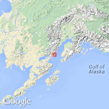
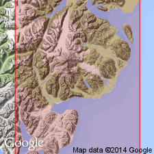
Type section: on Tonnie Creek, starting 5,000 ft S. 47 deg. E. of Tonnie Peak and continuing upstream for 500 ft, Cook Inlet region, Iniskin Peninsula, southwestern AK. Named from Twist Creek, a tributary of Fitz Creek.
Source: US geologic names lexicon (USGS Bull. 1350, p. 785); supplemental information from GNU records (USGS DDS-6; Menlo GNULEX).
- Usage in publication:
-
- Twist Creek Siltstone*
- Modifications:
-
- Overview
- AAPG geologic province:
-
- Alaska Southwestern region
Summary:
Pg. 34-35, pl. Twist Creek Siltstone of Tuxedni Group. Outcrops of the Twist Creek Siltstone on Iniskin Peninsula are confined to three narrow northeast-trending belts. Best exposures are in hills along flanks of Tonnie syncline, where the nonresistant siltstone is preserved between the resistant sandstone of the underlying and overlying formations. Maximum outcrop width is about 1,000 feet near northeast end of syncline where the beds cross axis of structure. Southwest of this point the belts become narrower as the unconformity between the Twist Creek Siltstone and Bowser Formation cuts out part of section. Belt of the Twist Creek along east flank of Havenstrite Ridge is somewhat wider than the ones along the hills northwest of Fitz Creek because the beds are exposed in the dip slope. In vicinity of Hickerson Lake the siltstone emerges from beneath a lava flow on southside of Boulder Creek. From here the formation continues northeast to Bear Creek near Tuxedni Bay. Angular unconformity exists between the Twist Creek and Bowser Formation. Overlies Cynthia Falls Sandstone. Thicknesses: 420 feet on Gaikema Creek; 400 feet on Cliff Creek; 240 feet on Tonnie Creek; and 100 feet in headwaters of Fitz Creek.
Source: US geologic names lexicon (USGS Bull. 1350, p. 785).
For more information, please contact Nancy Stamm, Geologic Names Committee Secretary.
Asterisk (*) indicates published by U.S. Geological Survey authors.
"No current usage" (†) implies that a name has been abandoned or has fallen into disuse. Former usage and, if known, replacement name given in parentheses ( ).
Slash (/) indicates name conflicts with nomenclatural guidelines (CSN, 1933; ACSN, 1961, 1970; NACSN, 1983, 2005, 2021). May be explained within brackets ([ ]).