- Usage in publication:
-
- Twin Pine Tuff
- Modifications:
-
- Named
- Dominant lithology:
-
- Tuff
- Rhyolite
- AAPG geologic province:
-
- New England province
Summary:
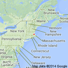
Late Proterozoic Mattapan Volcanic Complex, south and west of Boston is here subdivided into the older Twin Pine Tuff and the younger High Rock Tuff (new names). High Rock Tuff includes the ash-flow tuffs of Needham, Newton, and the west side of the Stony Brook Reservation, while Twin Pine Tuff includes the ash-flow tuffs of Westwood, Sherborn, and the east side of Stony Brook Reservation. High Rock averages 25 to 35 percent crystals; Twin Brook averages 5 to 20 percent. In both units, plagioclase is more abundant than quartz and perthite. Pumice in the younger tuff is almost totally obscured by recrystallization; pumice lapilli are more abundant in the Twin Pine and are flattened so that outcrops appear foliated. The High Rock is massive except for local columnar jointing. These high-silica rhyolites differ in color. Fresh surfaces of the Twin Pine are consistently dark gray; fresh surfaces of the High Rock are pinkish or greenish gray. The two units probably did not form continuous "layer-cake" deposits over greater Boston. Partial stratigraphic sections from five study areas are juxtaposed. Thickness of the High Rock at Needham estimated at 865 m; thickness of the Twin Brook at Westwood is a minimum of 1,000 m. Mattapan ash-flow tuffs intruded by Westwood Granite, which has been dated at 579+/-23 Ma (Zartman and Naylor, 1984).
Source: GNU records (USGS DDS-6; Reston GNULEX).
For more information, please contact Nancy Stamm, Geologic Names Committee Secretary.
Asterisk (*) indicates published by U.S. Geological Survey authors.
"No current usage" (†) implies that a name has been abandoned or has fallen into disuse. Former usage and, if known, replacement name given in parentheses ( ).
Slash (/) indicates name conflicts with nomenclatural guidelines (CSN, 1933; ACSN, 1961, 1970; NACSN, 1983, 2005, 2021). May be explained within brackets ([ ]).

