- Usage in publication:
-
- Tuscahoma
- Modifications:
-
- First used
- Dominant lithology:
-
- Sand
- Clay
- Marl
- AAPG geologic province:
-
- Mid-Gulf Coast basin
Summary:
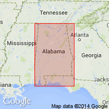
Tuscahoma (Bells Landing) shown on map as underlying Bashi (Wood's Bluff) and overlying Nanafalia. Units not defined. [Described by E.A. Smith and L.C. Johnson (1887: USGS Bull. 43) as Bell's Landing series (a name preempted by Smith, himself, in 1883). In Bulletin 43, Bells Landing series is described as (descending): (1) 40 ft of reddish sands and laminated gray sandy clays; (2) Bell's Landing marl bed proper (fossiliferous marl, 10 ft thick, containing some greensand); (3) gray sandy clays, 20-25 ft; (4) Gregg's Landing marl, 4-5 ft; and (5) 60 ft of sandy clays of prevailingly gray color with 1-ft marl bed about 10 ft above base. Underlies Wood's Bluff or Bashi series and unconformably overlies Nanafalia series.]
Source: GNU records (USGS DDS-6; Reston GNULEX).

- Usage in publication:
-
- Tuscahoma sand*
- Modifications:
-
- Overview
- AAPG geologic province:
-
- Mid-Gulf Coast basin
Summary:
Though Bells Landing series has one year's priority over Tuscahoma, it has been used in two senses and therefore is replaced. Tuscahoma belongs in Wilcox group and contains deposits of both marine and nonmarine origin. Age is early Eocene.
Source: GNU records (USGS DDS-6; Reston GNULEX).
- Usage in publication:
-
- Tuscahoma formation
- Modifications:
-
- Areal extent
- Overview
- Revised
- AAPG geologic province:
-
- Mid-Gulf Coast basin
Summary:
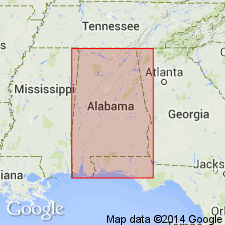
Tuscahoma extends entirely across state of AL and consists of about 200 ft of unfossiliferous cross-bedded sand and stratified sandy clay. In central and western AL, contains two fossiliferous marl beds, Greggs Landing marl and Bells Landing marl. Formation is here considered to include all the strata up to the base of the Bashi marl. It is thus extended to include the 3-foot lignite bed and overlying cross-bedded sand and sandy clay strata, about 70 ft thick, that have been included heretofore in Bashi formation. Overlies Nanafalia formation.
Source: GNU records (USGS DDS-6; Reston GNULEX).
- Usage in publication:
-
- Tuscahoma sand*
- Modifications:
-
- Areal extent
- AAPG geologic province:
-
- South Georgia sedimentary province
Summary:
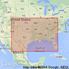
Tuscahoma sand. Correlation chart of outcropping Tertiary formation of eastern Gulf region shows Tuscahoma sand present in Georgia. [Age is early Eocene.]
Source: US geologic names lexicon (USGS Bull. 1200, p. 3987).
- Usage in publication:
-
- Tuscahoma Sand
- Modifications:
-
- Overview
- AAPG geologic province:
-
- Mid-Gulf Coast basin
Summary:
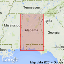
According to the usage of the AL Geological Survey, the Tuscahoma Sand in the Wilcox Group is light-gray to light-olive-gray interlaminated with thin-bedded carbonaceous silt and clay. Thin lignite beds occur locally. Two richly fossiliferous beds in the lower part of the Tuscahoma are given member status. The lower Greggs Landing Marl Member is a 6-foot-thick calcareous, glauconitic, silty sand or clayey silt containing lignite, abundant fossils, and small spheroidal concretions. The upper Bells Landing Marl Member is 9 ft thick and is a very fine grained glauconitic, fossiliferous sand, containing large pillow-shaped concretions. The Tuscahoma crops out in the Coastal Plain where thickness ranges from 350 ft in Choctaw Co. to 90 ft in Henry Co. Thickness is 650 ft in the subsurface of Clarke Co. Age is late Paleocene (middle and upper Thanetian)
Source: GNU records (USGS DDS-6; Reston GNULEX).
- Usage in publication:
-
- Tuscahoma Formation*
- Modifications:
-
- Biostratigraphic dating
- AAPG geologic province:
-
- Mid-Gulf Coast basin
Summary:
Tuscahoma Formation shown as Paleocene (Wilcox) age on fig. 1. Wilcox age based on CRASSATELLA TUMIDULA and CRASSATELLA AQUIANA collected from Wilcox and Monroe Cos., central AL.
Source: GNU records (USGS DDS-6; Reston GNULEX).
- Usage in publication:
-
- Tuscahoma Formation
- Modifications:
-
- Biostratigraphic dating
- AAPG geologic province:
-
- Mid-Gulf Coast basin
Summary:
A "fish bed" has been discovered in the Tuscahoma Formation. The fish fauna is of late Paleocene age (late Thanetian Stage) and possibly represents an estuarine paleoenvironment. The fauna compare favorably with deposits in England, Belgium, France, and Morocco. Many rodent teeth and vertebrae of snakes are found in association with the selachian and teleostean teeth, scutes, and vertebrae, as well as abundant fish coprolites. Report includes discussion of historical geology of the Tuscahoma.
Source: GNU records (USGS DDS-6; Reston GNULEX).
- Usage in publication:
-
- Tuscahoma Formation*
- Modifications:
-
- Biostratigraphic dating
- AAPG geologic province:
-
- Mid-Gulf Coast basin
Summary:
The Tuscahoma Formation in Alabama is included in calcareous nannofossil zone NP9 and is of late Paleocene age. The Tuscahoma overlies the Nanafalia Formation and unconformably underlies the Bashi Formation. The Paleocene-Eocene boundary (Zones NP9-NP10 boundary) occurs in the hiatus between the Tuscahoma and Bashi.
Source: GNU records (USGS DDS-6; Reston GNULEX).
For more information, please contact Nancy Stamm, Geologic Names Committee Secretary.
Asterisk (*) indicates published by U.S. Geological Survey authors.
"No current usage" (†) implies that a name has been abandoned or has fallen into disuse. Former usage and, if known, replacement name given in parentheses ( ).
Slash (/) indicates name conflicts with nomenclatural guidelines (CSN, 1933; ACSN, 1961, 1970; NACSN, 1983, 2005, 2021). May be explained within brackets ([ ]).

