- Usage in publication:
-
- Turquoise granite*
- Modifications:
-
- Named
- Dominant lithology:
-
- Granite
- AAPG geologic province:
-
- Pedregosa basin
Summary:
Pg. 8, 65-67, pl. 5. Turquoise granite. Highly sericitic, silicified granite. Contains about 50 percent sausseritic albite, 30 percent microcline, 15 percent quartz, and the rest is chlorite, and accessory minerals (zoisite, seriate, etc). Extremely altered. Poorly exposed; hence, its relations to adjacent formations can only locally be unequivocally determined. Exposures north and south of Brown's Peak clearly indicate that it intrudes Bolsa quartzite and Pinal schist. Boundaries with Gleeson quartz monzonite and Copper Belle monzonite porphyry (both new) are faults, and none of these three rocks show facies changes that are noticeably related to the contacts. Known to be of post-Cambrian age and is probably post-Paleozoic, but is older than period of thrust faulting that has affected region, as shown not only by the faults referred to but also by flat fault contact beneath block of Escabrosa limestone resting on it on south wall of Arroyo that divides Brown's Peak from Gleeson Hill. Relations with Sugarloaf quartz latite (new) uncertain, owing to intense sericitization that both rocks have undergone along their mutual contacts. Age is early Mesozoic (Triassic or Jurassic). Report includes geologic map.
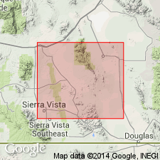
Named from Turquoise Ridge, west of Courtland, in secs. 17, 20, and 23, T. 19 S., R. 25 E., on west slope of which it is widely exposed, central Cochise Co., southeastern AZ.
Source: US geologic names lexicon (USGS Bull. 1200, p. 3985-3986); supplemental information from GNU records (USGS DDS-6; Denver GNULEX).

- Usage in publication:
-
- Turquoise Granite*
- Modifications:
-
- Age modified
- AAPG geologic province:
-
- Pedregosa basin
Summary:
Shown as Jurassic on pl. 4. Is in the southern Dragoon Mountains, Cochise Co, AZ in the Pedregosa basin. Previously assigned to the Triassic or Jurassic.
Source: GNU records (USGS DDS-6; Denver GNULEX).
For more information, please contact Nancy Stamm, Geologic Names Committee Secretary.
Asterisk (*) indicates published by U.S. Geological Survey authors.
"No current usage" (†) implies that a name has been abandoned or has fallen into disuse. Former usage and, if known, replacement name given in parentheses ( ).
Slash (/) indicates name conflicts with nomenclatural guidelines (CSN, 1933; ACSN, 1961, 1970; NACSN, 1983, 2005, 2021). May be explained within brackets ([ ]).

