

- Usage in publication:
-
- Turlock Lake formation
- Modifications:
-
- Named
- Dominant lithology:
-
- Sand
- Gravel
- Silt
- AAPG geologic province:
-
- San Joaquin basin
Summary:
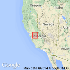
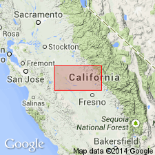
Named for oldest post-Mehrten exposures in eastern Stanislaus Co, CA for Turlock Lake. Type section designated in roadcuts on hill in Turlock Lake State Park, NW/4 SE/4, SW/4 SE/4, SE/4 SW/4, NE/4 SW/4 sec.31 T3S T13E, Cooperstown 7.5' quad. Crops out in northwest-southeast trending belt of variable width. Also occurs in subsurface. Consists of sand, gravel, and silt. Thickness at type is 51 ft. Probably thickness ranges from 300 to 850 ft as shown on geologic cross section. Conformably overlies Mehrten Formation. Crops out east of younger Riverbank Formation (new). Is probably continuous with Laguna Formation of Mokelumne area. Age given in summary chart as late Pliocene to early Pleistocene.
Source: GNU records (USGS DDS-6; Menlo GNULEX).
- Usage in publication:
-
- Turlock Lake Formation*
- Modifications:
-
- Adopted
- Reference
- Revised
- AAPG geologic province:
-
- San Joaquin basin
Summary:
Turlock Lake Formation of Davis and Hall (1959) is adopted. Type section redescribed in new roadcuts E/2 SW/4 sec.31 T3S R13E, Cooperstown 7.5' quad, Stanislaus Co, CA. Reference sections also designated, one along new HWY west of junction with access road to Turlock Lake State Park and other in roadcut leading up Negro Hill in Snelling 7.5' quad, Merced Co, CA. Divided into lower and upper unit. Upper unit contains Corcoran Clay member (in western San Joaquin Valley) and overlying Friant Pumice member. Turlock Lake Formation consists primarily of arkosic alluvium, mostly fine sand, silt, and in places clay in lower part grading upward into coarse sand and pebbly sand or gravel. Unconformably overlies Mehrten Formation in type area. Overlies North Merced Gravel or Laguna Formation where North Merced is absent. Underlies Riverbank Formation. Age of lower unit is younger than North Merced Gravel believed to be about 1 Ma. Age of upper unit appears to be about 0.60 Ma based on its normal magnetic polarity, vertebrate fauna, uranium-trend ages, and on stratigraphic relations. Age of Turlock Lake Formation is Pleistocene.
Source: GNU records (USGS DDS-6; Menlo GNULEX).
For more information, please contact Nancy Stamm, Geologic Names Committee Secretary.
Asterisk (*) indicates published by U.S. Geological Survey authors.
"No current usage" (†) implies that a name has been abandoned or has fallen into disuse. Former usage and, if known, replacement name given in parentheses ( ).
Slash (/) indicates name conflicts with nomenclatural guidelines (CSN, 1933; ACSN, 1961, 1970; NACSN, 1983, 2005, 2021). May be explained within brackets ([ ]).