The National Geologic Map Database is migrating to a new infrastructure. We apologize for any service disruptions during this process.
|
|---|


- Usage in publication:
-
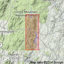
- Turkey Mountain metabasalt member*
- Modifications:
-
- Overview
- Dominant lithology:
-
- Basalt
- Greenstone
- AAPG geologic province:
-
- New England province
Summary:
Discontinuous lenses of metabasalt, informally referred to as Turkey Mountain metabasalt member of Hoosac Formation, actually occur at different stratigraphic positions extending through a stratigraphic distance of 100 to 400 m above base of Hoosac Formation. From type area on Turkey Mountain in Saxtons River quad south to Massachusetts State line, basalts form at least three relatively persistent units (Ratcliffe, 1991). Basalt mapped in northeast corner of this map, above Wilmington thrust system, correlates with type Turkey Mountain. As used here, Turkey Mountain metabasalt member consists of several laterally and vertically discontinuous, nonidentical flows and volcaniclastic deposits including, but not restricted to, type Turkey Mountain Member of Hoosac Formation as used by Doll and others (1961) and by Skehan (1961). They mapped the lower basalts as unnamed greenstones in Hoosac Formation. Turkey Mountain metabasalt member consists of light-green to dark-green epidote-amphibole greenstones and amphibolite metabasalts. Metabasalt varies from massive to very well layered. Finely laminated, quartzose and epidotitic volcaniclastic beds several centimeters thick are interlayered with more massive, strongly foliated, black amphibolite. Where in contact with surrounding metasedimentary rocks, layering within metabasalt and volcaniclastic beds is concordant and gradational with enclosing metasediment. Light-gray or yellowish-greenish-gray, well-laminated quartzite or, less commonly, gritty, pebbly conglomerate 0.5 to 5 m thick marks upper contact with unnamed granofels member of Hoosac Formation. Base of Turkey Mountain metabasalt member in contact with rusty muscovite-albite-biotite schist. Metabasalts probably originated as thin composite basalt lava flows that contained intercalated basaltic volcaniclastic rocks. Age is Late Proterozoic and Early Cambrian.
Source: GNU records (USGS DDS-6; Reston GNULEX).
- Usage in publication:
-
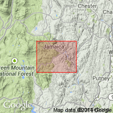
- Turkey Mountain Member*
- Modifications:
-
- Revised
- AAPG geologic province:
-
- New England province
Summary:
Turkey Mountain Member is formalized as a member of Hoosac Formation to include all metabasalts within the formation. Exposed for a distance of 3 km northwest of Townshend. Consists of a collection of massive black amphibolite layers, 1 to 2 m thick, interlayered with epidotitic and quartz-rich, laminated greenstones. Total thickness of interbedded amphibolite and associated metasedimentary rock on Turkey Mountain is as much as 200 m. Termination of Turkey Mountain Member northward appears to result from thinning to the north although fault truncation along its lower contact cannot be ruled out. To the south, Turkey Mountain Member also appears to thin by interbedding with enclosing metasedimentary rocks, and pinches out north of Townshend. Where several layers in a limited region can be separately mapped, they are each referred to informally by use of subscripts in the letter symbol; this, however, does not imply correlation of numbered layers between different areas of the map.
Source: GNU records (USGS DDS-6; Reston GNULEX).
For more information, please contact Nancy Stamm, Geologic Names Committee Secretary.
Asterisk (*) indicates published by U.S. Geological Survey authors.
"No current usage" (†) implies that a name has been abandoned or has fallen into disuse. Former usage and, if known, replacement name given in parentheses ( ).
Slash (/) indicates name conflicts with nomenclatural guidelines (CSN, 1933; ACSN, 1961, 1970; NACSN, 1983, 2005, 2021). May be explained within brackets ([ ]).