

- Usage in publication:
-
- Tupelo tongue*
- Modifications:
-
- Named
- Dominant lithology:
-
- Sand
- AAPG geologic province:
-
- Black Warrior basin
Summary:
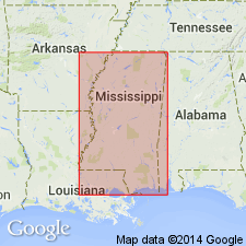
Tupelo tongue (new name) is a tongue of uppermost part of Coffee sand member of Eutaw formation, resting on Mooreville tongue of Selma chalk and overlain by a large body of Selma chalk. The material composing the tongue is dark-gray, chiefly massive calcareous glauconitic sand. Thickness 100 ft. Geographic extent about 100 mi in Lee Co.
Source: GNU records (USGS DDS-6; Reston GNULEX).
- Usage in publication:
-
- Tupelo Tongue
- Modifications:
-
- Revised
- AAPG geologic province:
-
- Black Warrior basin
Summary:
A richly fossiliferous interval in the middle of the lower half of the Tupelo Tongue of the Coffee Sand has been exposed in the vicinity of Chapelville, Lee Co., MS. The interval is here informally named the Chapelville fossiliferous horizon. It is estimated to contain between 200 and 300 molluscan species of Campanian age. A complete study will be published as a three-part bulletin series. A measured section of the horizon at the Friendship-Pratt Road locality where it was cored shows the thickness as slightly less than 3 m, or 2 ft greater than observed in the adjacent outcrop.
Source: GNU records (USGS DDS-6; Reston GNULEX).
For more information, please contact Nancy Stamm, Geologic Names Committee Secretary.
Asterisk (*) indicates published by U.S. Geological Survey authors.
"No current usage" (†) implies that a name has been abandoned or has fallen into disuse. Former usage and, if known, replacement name given in parentheses ( ).
Slash (/) indicates name conflicts with nomenclatural guidelines (CSN, 1933; ACSN, 1961, 1970; NACSN, 1983, 2005, 2021). May be explained within brackets ([ ]).