The National Geologic Map Database is migrating to a new infrastructure. We apologize for any service disruptions during this process.
|
|---|


- Usage in publication:
-
- Tungstonia Granite
- Modifications:
-
- Named
- Geochronologic dating
- Dominant lithology:
-
- Granite
- AAPG geologic province:
-
- Great Basin province
Summary:
Unit is named the Tungstonia Granite. Consists of allotriomorphic to hypidiomorphic granite forming castle-like monoliths. Border facies consists of protoclastic mylonite and leucocratic aplitic granite; core facies consists of muscovite-biotite granite with muscovite books. Age is Paleocene based on isotopic (K-Ar, Rb-Sr) dating.
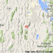
Type locality not stated by authors. Named from Tungstonia Canyon and abandoned mine, Kern Mountains, White Pine Co., NV.
Source: US geologic names lexicon (USGS Bull. 1520, p. 316); GNU records (USGS DDS-6; Menlo GNULEX).
For more information, please contact Nancy Stamm, Geologic Names Committee Secretary.
Asterisk (*) indicates published by U.S. Geological Survey authors.
"No current usage" (†) implies that a name has been abandoned or has fallen into disuse. Former usage and, if known, replacement name given in parentheses ( ).
Slash (/) indicates name conflicts with nomenclatural guidelines (CSN, 1933; ACSN, 1961, 1970; NACSN, 1983, 2005, 2021). May be explained within brackets ([ ]).