The National Geologic Map Database is migrating to a new infrastructure. We apologize for any service disruptions during this process.
|
|---|


- Usage in publication:
-
- Tullock member*
- Modifications:
-
- Original reference
- Dominant lithology:
-
- Shale
- Coal
- Sandstone
- AAPG geologic province:
-
- Central Montana uplift
- Powder River basin
Summary:
Pg. 29. The upper member of Lance formation in Tullock Creek coal field, Montana, is herein named Tullock member, from exposures in valley of Tullock Creek [in T. 3 N., R. 35 E., Treasure County]. It consists of yellowish sandstone and shale and contains 10 more or less lenticular coal beds. The rocks resemble lower portion of the Lance in a general way, but certain differences are apparent on close examination. Although the sandstone is lithologically similar to that in lower part of formation, it commonly occurs in beds less than 20 feet thick, which seem to be more persistent than the thicker ones that are common in lower part of the Lance. Much of the sandstone and shale is more or less calcareous, but true limestone was seen at only one point. The shale is chiefly yellowish gray to brownish, and the faint greenish tint so charaderistic of the shale in lower part of Lance is very uncommon. Many bands of carbonaceous shale are present, which help to give it a brownlsh-yellow cast. Thickness 300 feet. Overlain by Lebo shale member of Fort Union formation.
Source: US geologic names lexicon (USGS Bull. 896, p. 2192-2193).

- Usage in publication:
-
- Tullock formation*
- Modifications:
-
- Age modified
- AAPG geologic province:
-
- Central Montana uplift
- Powder River basin
Summary:
The part of Lance formation that underlies the Tullock deposits was later named Hell Creek member of Lance formation, but in Dec. 1935 the Tullock and Hell Creek deposits were raised to rank of formations by the USGS, the age of Hell Creek formation was changed to Late Cretaceous, and the age of Tullock formation was changed to Late Cretaceous or Eocene. These changes were based upon a large amount of additional field work over extensive areas.
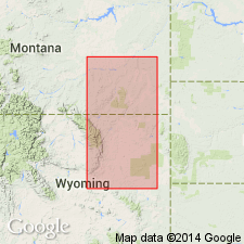
Recognized in central southern, southeastern, and northeastern MT.
Source: US geologic names lexicon (USGS Bull. 896, p. 2192-2193).
- Usage in publication:
-
- Tullock Member*
- Modifications:
-
- Areal extent
- AAPG geologic province:
-
- Williston basin
Summary:
Is lowest member of Fort Union Formation in eastern Custer Co, MT in Williston basin. Is mapped only in northwest corner of quadrangle and is laterally equivalent to lower part of Ludlow Member of Fort Union Formation where Lebo Member and Tullock cannot be separately mapped. Overlies Upper Cretaceous Hell Creek Formation and is conformably overlain by Lebo Member of Fort Union Formation. Is assigned to Paleocene Epoch.
Source: GNU records (USGS DDS-6; Denver GNULEX).
- Usage in publication:
-
- Tullock Member*
- Modifications:
-
- Areal extent
- AAPG geologic province:
-
- Williston basin
Summary:
Is lowest member of Fort Union Formation in eastern Custer Co, MT in Williston basin. Is mapped only in northern part of quadrangle and in small area west of divide that separates Powder River from Mizpah Creek. Beyond arbitrary cut-off, is laterally equivalent to lower part of Ludlow Member of Fort Union Formation where Lebo Member and Tullock cannot be separately mapped. Gradational contact with underlying Upper Cretaceous Hell Creek Formation and with overlying Lebo Member of Fort Union Formation. Is assigned to Paleocene Epoch.
Source: GNU records (USGS DDS-6; Denver GNULEX).
- Usage in publication:
-
- Tullock Formation
- Modifications:
-
- Revised
- AAPG geologic province:
-
- Williston basin
Summary:
Revised in that Tullock [of Fort Union Group] divided into two newly named members--the lower member is named Nelson Ranch Member and the upper member is named Collins Ranch Member. Overlies Hell Creek Formation; lower contact placed at base of upper Z-coal; K/T boundary is 1-6 m below base of upper Z-coal. Underlies Lebo Formation [of Fort Union Group] unconformably where channel sandstones have cut down into Lebo; elsewhere contact is placed at base of U-coal. Geologic map. Columnar section. Measured sections. The Nelson Ranch is a cyclic-appearing unit of gray sandstone, shale, and mudstone with some concretionary and laminated ironstone and claystone; the Nelson Ranch includes the upper Z-, Y-, X-, and W-coals. The Collins Ranch extends from the top of the W-coal to the top of the U-coal; includes the V-coal; sandstones of the Collins Ranch are tan and moderately resistant. The coal beds are the uppermost units of definable cycles. Ranges between 55 m in the southeast part of area to 60+ m in northern part of area, McCone Co, MT in the Williston basin. Paleocene age.
Source: GNU records (USGS DDS-6; Denver GNULEX).
- Usage in publication:
-
- Tullock Member*
- Modifications:
-
- Areal extent
- AAPG geologic province:
-
- Powder River basin
Summary:
Maps show outcrop extent of Tullock Member, basal member of Fort Union Formation, in Powder River basin, southeast MT, northeast WY. Member 90 m thick in northwest part of basin; 400 m thick southeast part of basin. Identified in field by subtle change in color from gray-green of underlying Hell Creek (MT) and Lance (WY) Formations to yellow or buff of Tullock. Base of Tullock placed by these authors at base of first "persistent" coal bed or zone above dinosaur-bearing beds of Lance or Hell Creek. Persistent coal bed of East Burnt Creek, Treasure Co, MT, Central Montana uplift, about 3 m above K-T boundary. If base of the coal is used as Hell Creek-Tullock contact, rather than subtle color change, Hell Creek Late Cretaceous and earliest Paleocene age locally. Upper contact with Lebo Member of Fort Union gradational and marked by change from buff (Tullock) to gray (Lebo). Age of Tullock early Paleocene on basis of fossil palynomorphs. Sixty-seven taxa representing bryophytes (ferns, sphagnum moss), gymnosperm, angiosperm pollen, and algal cysts. Fern spores indicate wet lowland environment, peat-forming mires. Conifer pollen persistent but not abundant probably transported in from upland areas. Palm, deciduous trees also present in Tullock forests. Pollen genus MOMIPITES first appears in Powder River basin in middle part of Tullock. Palynoflora dominated by angiosperm pollen. Tullock environment spread from southeast to northwest across basin.
Source: GNU records (USGS DDS-6; Denver GNULEX).
For more information, please contact Nancy Stamm, Geologic Names Committee Secretary.
Asterisk (*) indicates published by U.S. Geological Survey authors.
"No current usage" (†) implies that a name has been abandoned or has fallen into disuse. Former usage and, if known, replacement name given in parentheses ( ).
Slash (/) indicates name conflicts with nomenclatural guidelines (CSN, 1933; ACSN, 1961, 1970; NACSN, 1983, 2005, 2021). May be explained within brackets ([ ]).