


- Usage in publication:
-
- Tule Formation
- Modifications:
-
- Mapped 1:250k
- Dominant lithology:
-
- Sand
- Silt
- Clay
- Gravel
- AAPG geologic province:
-
- Permian basin
Summary:
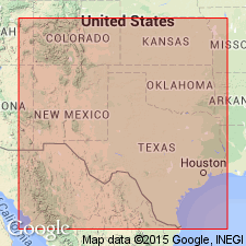
Is Pleistocene formation mapped in southwestern part of map sheet in upper reaches of Double Mountain Fork Brazos River in southeastern Lynn and southwestern Garza Cos, TX (northeastern Permian basin). Map unit described as sand, silt, and clay, gravel at base. Sand, fine- to medium-grained quartz, silty in part, some caliche nodules, thin-bedded to massive, white, gray, brownish gray, grayish red. Silt and clay, locally bentonitic, indistinctly bedded, light gray, olive gray, greenish gray; weathers white, light gray, pink. Molluscan and vertebrate fossils. Thickness 85 ft, feathers out laterally. (Kansan)
Source: GNU records (USGS DDS-6; Denver GNULEX).
- Usage in publication:
-
- Tule Formation
- Modifications:
-
- Biostratigraphic dating
- Geochronologic dating
- Paleomagnetics
- AAPG geologic province:
-
- Permian basin
Summary:
Pg. 240+ (fig. 7.1). Tule Formation. Recognized in Texas. Includes (descending): Lava Creek B ash (Pearlette type O), about 0.67 Ma; Mayfield Ranch fauna; Rock Creek fauna; Martin Ranch fauna; and Cerro Toledo X ash, about 1.2 to 1.3 Ma (by tentative correlation). Age is Irvingtonian NALMA; Matuyama to Brunhes chron zone (reversed polarity zone 1r.2r to normal polarity zone 1n).
Source: Publication.
For more information, please contact Nancy Stamm, Geologic Names Committee Secretary.
Asterisk (*) indicates published by U.S. Geological Survey authors.
"No current usage" (†) implies that a name has been abandoned or has fallen into disuse. Former usage and, if known, replacement name given in parentheses ( ).
Slash (/) indicates name conflicts with nomenclatural guidelines (CSN, 1933; ACSN, 1961, 1970; NACSN, 1983, 2005, 2021). May be explained within brackets ([ ]).