The National Geologic Map Database is migrating to a new infrastructure. We apologize for any service disruptions during this process.
|
|---|


- Usage in publication:
-
- Tularosa Canyon Rhyolite
- Modifications:
-
- Named
- Dominant lithology:
-
- Tuff
- Sandstone
- AAPG geologic province:
-
- Basin-and-Range province
Summary:
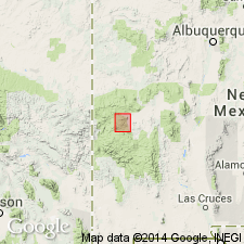
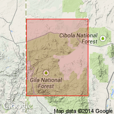
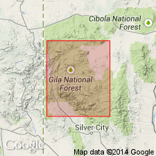
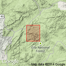
Named for Tularosa Canyon (for which it is named), where type section measured in sec 33, T6S, R18W, Catron Co, NM in Basin-and-Range province. At type is about 40 m thick and consists of poorly welded ash-flow tuff and interbedded tuffaceous sandstone [rhyolite not mentioned in author's lithologic description]. Lies with slight angular unconformity upon andesitic breccia and clastic sedimentary rocks of the precauldron sequence that crops out around rim of Squirrel Springs depression; this depression, on northwestern rim of Mogollon plateau, forms a terraced structural basin in which the youngest volcanic rocks are ponded. The ash-flow tuff has been dated by fission-track method at 30.7 +/-1.6 m.y. (Smith and others, 1974). Contains sparse phenocrysts of sanidine, plagioclase, quartz, biotite, and hornblende in a glassy to devitrified vitroclastic matrix. Is in part correlative with the lower rhyolite pyroclastic unit around western end of the San Augustin Plains (Stearns, 1962). Crops out at several localities on western, northern, and eastern rim of Squirrel Springs depression and has been identified in San Francisco Mountains 30 km to west. Thickness within cauldron unknown; does not crop out in center of depression. Flow direction suggests the buried cauldron as source for the tuff, probably through ring fractures rather than central vent. Oligocene age. Stratigraphic chart.
Source: GNU records (USGS DDS-6; Denver GNULEX).
- Usage in publication:
-
- Tularosa Canyon Rhyolite
- Modifications:
-
- Revised
- AAPG geologic province:
-
- Basin-and-Range province
Summary:
Tularosa Canyon Andesite revised--upper contact newly named in this report. Report area is northwestern part of Mogollon plateau, Catron Co, NM, Basin-and-Range province. Squirrel Springs Canyon Andesite (new) overlies Tularosa Canyon conformably in Tularosa Canyon, and in most other places. At The Mesa, on western edge of the San Augustin Plains, Squirrel Springs Canyon interfingers with uppermost Tularosa Canyon. Is of Oligocene age based on stratigraphic position. Stratigraphic chart.
Source: GNU records (USGS DDS-6; Denver GNULEX).
- Usage in publication:
-
- Tularosa Canyon Rhyolite
- Modifications:
-
- Geochronologic dating
- AAPG geologic province:
-
- Basin-and-Range province
Summary:
This report presents new fission-track ages for Tertiary volcanic rocks in the Mogollon plateau, southwestern NM. In the Tularosa Mountains the Squirrel Springs Canyon Andesite overlies Tularosa Canyon Rhyolite and directly underlies the Apache Spring Quartz Latite. A sample of Tularosa Canyon taken from SW1/4 sec 34, T6S, R17W, Catron Co, NM, Basin-and-Range province, produced a fission-track date on sphene of 30.7 +-1.3 m.y.
Source: GNU records (USGS DDS-6; Denver GNULEX).
- Usage in publication:
-
- Tularosa Canyon Rhyolite
- Modifications:
-
- Geochronologic dating
- AAPG geologic province:
-
- Basin-and-Range province
Summary:
Has yielded ages of 29.7 +/-1.5 m.y. (biotite) and 27.1 +/-2.0 m.y. (feldspar mixture), Milligan Mountain quad, Catron Co, NM and 31.6 +/-2.0 m.y., Eagle Peak quad, and 30.5 +/-3.8 m.y. (zircon), Alegres Mountain quad, all in Catron Co, NM, Basin-and-Range province. [These dates are generally regarded as Oligocene.]
Source: GNU records (USGS DDS-6; Denver GNULEX).
- Usage in publication:
-
- Tularosa Canyon Rhyolite†
- Modifications:
-
- Abandoned
Summary:
Abandoned. Former Tularosa Canyon has been found to consist of two regional ignimbrite outflow sheets (ascending): Davis Canyon Tuff from the Mogollon Mountains caldera complex 20-25 km to south of quad and Vicks Peak Tuff from Nogal Canyon cauldron in southern San Mateo Mountains about 100 km to east of quad. Smith and Rhodes (1974) proposed the source of the Tularosa Canyon to be the Squirrel Springs cauldron which they tentatively located by flow directions in the Tularosa Mountains to north of Milligan Mountain quad. However, as actual sources for the tuffs have been found elsewhere, the need for the proposed Squirrel Springs cauldron is eliminated and the name Tularosa Canyon Rhyolite serves no useful purpose and is herein abandoned and replaced by Davis Canyon and Vicks Peak Tuffs in this quad. [Davis Canyon and Vicks Peak are not everywhere present together; where either or both are present they replace Tularosa Canyon.] [Modern practice is to assign formation-rank to major tuff deposits from individual calderas.] Study area is in Catron Co, southwest NM, Basin-and-Range province.
Source: GNU records (USGS DDS-6; Denver GNULEX).
For more information, please contact Nancy Stamm, Geologic Names Committee Secretary.
Asterisk (*) indicates published by U.S. Geological Survey authors.
"No current usage" (†) implies that a name has been abandoned or has fallen into disuse. Former usage and, if known, replacement name given in parentheses ( ).
Slash (/) indicates name conflicts with nomenclatural guidelines (CSN, 1933; ACSN, 1961, 1970; NACSN, 1983, 2005, 2021). May be explained within brackets ([ ]).