The National Geologic Map Database is migrating to a new infrastructure. We apologize for any service disruptions during this process.
|
|---|


- Usage in publication:
-
- Tub Spring member*
- Modifications:
-
- Named
- Dominant lithology:
-
- Tuff
- Pumice
- AAPG geologic province:
-
- Great Basin province
Summary:
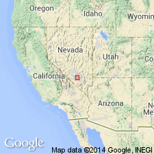
Named as one of eight members of Oak Spring formation for Tub Spring, northern part of the Test Site west of Oak Spring Butte, Nye Co, NV in the Great Basin province. No type locality designated, though the section at Tub Spring shown on cross section where it overlies the lower member of the Oak Spring and underlies Grouse Canyon member (new) of Oak Spring. Member is found on north and east sides of Yucca Flat. Consists of greenish-gray tuff, gray vitrophyre, reddish-brown partially welded pumice. Has inclusions of rhyolite, welded tuff, and Paleozoic rocks. Is nonwelded, gray, vitric at base. Fragments of pumice and rhyolite as much as 12 inches long found near pinchout 3 mi west of "type locality" [Tub Spring]. Phenocrysts of sanidine, anorthoclase, quartz, and mafic minerals make up 30 percent of rock. Is 0 to 250 ft thick. Forms cliffs and benches. Miocene? or younger age.
Source: GNU records (USGS DDS-6; Denver GNULEX).
- Usage in publication:
-
- Tub Spring Member*
- Modifications:
-
- Revised
- AAPG geologic province:
-
- Great Basin province
Summary:
Reassigned from Tub Spring Member of Oak Spring Formation to Tub Spring Member of Indian Trail Formation (new) of Oak Spring Group (rank raised). Overlies lower member of Indian Trail. Underlies Grouse Canyon Member of Indian Trail. Is a multiple-flow simple cooling unit of rhyolitic welded and nonwelded ash-flow tuff and associated ash-flow tuff. Wedges out south from Oak Spring Butte. Thickens and becomes more densely welded north of the butte. Is probably related to a volcanic center north of the Test Site. Of late Miocene or early Pliocene age. Cross section shows relation of member to other units in the Oak Spring from Skull Mountain (north) to area west of Oak Spring Butte (south), Nevada Test Site, Nye Co, NV in the Great Basin province.
Source: GNU records (USGS DDS-6; Denver GNULEX).
- Usage in publication:
-
- Tub Spring Member*
- Modifications:
-
- Revised
- AAPG geologic province:
-
- Great Basin province
Summary:
Underlies a large area north and west of the Nevada Test Site, Nye Co, NV, Great Basin province. Is assigned to the Indian Trail Formation, a formation restricted to the east part of the Test Site in this report, east of long 116 deg 15 min. West of long 116 deg 15 min in the west part of the Test Site, it is assigned as the basal member to the newly named Belted Range Formation. In the west part of the Test Site, it overlies and underlies local informal units. Is a compound cooling unit of buff, gray, locally brick red comenditic (peralkaline soda-rhyolite) ash-flow tuff. Soda-rich sanidine is the dominant phenocryst mineral. Fayalite, apatite, zircon, and sodic iron-rich clinopyroxene are minor ubiquitous phenocrysts. Contains abundant quartz phenocrysts. Can be as much as 300 ft thick locally. Ranges from poorly to densely welded. Is devitrified at most outcrops. Locally, contains large fragments of reddish-brown or buff pumice and lithic fragments of welded tuff and sedimentary rock. Distribution map. Nomenclature chart. Of Miocene or Pliocene age. Term Oak Spring as a group or as a formation abandoned.
Source: GNU records (USGS DDS-6; Denver GNULEX).
- Usage in publication:
-
- Tub Spring Member*
- Modifications:
-
- Age modified
- AAPG geologic province:
-
- Great Basin province
Summary:
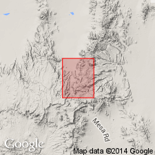
Mapped in Quartet Dome 7.5' quad, Nye Co, NV, where it is composed of lower (0 to 65 ft) unit of pale-yellow to pale-orange-brown nonwelded zeolitic ash-flow tuff and upper (0 to 95 ft) unit of pale gray poorly welded devitrified ash-flow tuff. Assigned Miocene and Pliocene(?) age based on stratigraphic relations.
Source: GNU records (USGS DDS-6; Menlo GNULEX).
- Usage in publication:
-
- Tub Spring Member*
- Modifications:
-
- Mapped
- AAPG geologic province:
-
- Great Basin province
Summary:
Tub Spring Member of Belted Range Tuff mapped in Groom Mine SW 7.5' quad, Nye and Lincoln Cos, NV. Described as compound cooling unit of gray to buff, dark-brown weathering, partially to densely welded comenditic ash-flow tuff. Is 150 to about 350 ft thick. Is Miocene age.
Source: GNU records (USGS DDS-6; Menlo GNULEX).
- Usage in publication:
-
- Tub Spring Member*
- Modifications:
-
- Age modified
- AAPG geologic province:
-
- Great Basin province
Summary:
Age is late[!] Miocene on basis of 15 to 13 Ma assigned to volcanic center located on eastern Pahute Mesa. Silent Canyon caldera formed during and/or just after eruption of Belted Range Tuff. [DNAG Scale, 1983, would be "middle Miocene"]
Source: GNU records (USGS DDS-6; Menlo GNULEX).
- Usage in publication:
-
- Tub Spring Member*
- Modifications:
-
- Revised
- AAPG geologic province:
-
- Great Basin province
Summary:
Belted Range Tuff extended southward thereby extending use of members of Belted Range Tuff rather than of Indian Trail Formation which is geographically restricted from Wheelbarrow Peak-Rainier Mesa area. Tub Spring Member as shown on map is 0 to about 300 ft thick and of Miocene age.
Source: GNU records (USGS DDS-6; Menlo GNULEX).
- Usage in publication:
-
- Tub Spring Member*
- Modifications:
-
- Revised
- AAPG geologic province:
-
- Great Basin province
Summary:
Indian Trail Formation at Nevada Test Site and vicinity is herein abandoned. Belted Range Tuff including its members should now be used throughout Nevada Test Site and vicinity. Ash flows from lower member of Indian Trail Formation now included in (ascending): Fraction Tuff, Redrock Valley Tuff, and Crater Flat Tuff (all three geographically extended).
Source: GNU records (USGS DDS-6; Menlo GNULEX).

- Usage in publication:
-
- Tub Spring Tuff*
- Modifications:
-
- Revised
- Geochronologic dating
- AAPG geologic province:
-
- Great Basin province
Summary:
Within southwest Nevada volcanic field, Nye Co, NV, Great Basin province, units previously of formation rank are raised to group rank to allow for combining petrographically, geochemically, and temporally related lava flows and nonwelded tuffs with the principal correlative welded ash-flow tuff sheets (formerly members of the previous formation-rank tuffs). The ash-flow sheets are raised to formation rank and designated as "Tuff." Tub Spring is raised to formation rank and removed from Belted Range Group (rank raised). Tub Spring, a peralkaline unit with an 40Ar/39Ar age 14.9 Ma (dated on sanidine; table 3), is removed from Belted Range because it is 1.2 m.y. older than Grouse Canyon Tuff (rank raised) of Belted Range and is overlain by up to 200 m of dominantly calc-alkaline bedded and nonwelded tuffs of Tunnel Formation (new) that underlie Grouse Canyon. Tub Spring is not comagmatic with rocks of Belted Range; source of Tub Spring is unknown. Younger than tuff of Yucca Flat. Nomenclature chart. Assigned Miocene age.
Source: GNU records (USGS DDS-6; Denver GNULEX).
For more information, please contact Nancy Stamm, Geologic Names Committee Secretary.
Asterisk (*) indicates published by U.S. Geological Survey authors.
"No current usage" (†) implies that a name has been abandoned or has fallen into disuse. Former usage and, if known, replacement name given in parentheses ( ).
Slash (/) indicates name conflicts with nomenclatural guidelines (CSN, 1933; ACSN, 1961, 1970; NACSN, 1983, 2005, 2021). May be explained within brackets ([ ]).