The National Geologic Map Database is migrating to a new infrastructure. We apologize for any service disruptions during this process.
|
|---|


- Usage in publication:
-
- Tuana Gravel*
- Modifications:
-
- Named
- Dominant lithology:
-
- Gravel
- Sand
- Silt
- Clay
- AAPG geologic province:
-
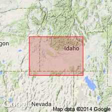
- Snake River basin
Summary:
Pg. 1199 (fig. 1), 1209-1210, pl. 1. Tuana Gravel of Idaho Group. Name applied to typical sequence of brown and gray beds of pebble gravel, sand, silt, and clay in Indian Butte (a prominence along Tuana Gulch) and to a patch of pediment gravel in upland drained by Bruneau River. At Indian Butte the Tuana is 200 feet thick. Eastward and northward from Indian Butte, the Tuana extends to bluffs of Snake River, where base of gravel is about 600 feet above river level; southward extends to upland plains drained by lower reach of Salmon Falls Creek. In Bruneau River area the Tuana extends northward to an eroded terminus 850 feet above Snake River, 6 miles southeast of Bruneau. In Tuana Gulch area, the Tuana overlies beds of flood-plain facies of Glenns Ferry Formation (new), which are truncated by angular unconformity that dips northward to average gradient 15 to 20 feet per mile. Not in actual contact with Bruneau Formation (new) but relations show that the Bruneau is stratigraphically younger. Age is early Pleistocene, based on stratigraphic position. Report includes generalized geologic map, cross section, stratigraphic chart.
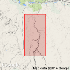
Type locality: Tuana Gulch, a tributary that drains upland plain, west of Hagerman, Gooding Co., southwestern ID.
[Discrepancy: GNU records (USGS DDS-6; Denver GNULEX, June 3, 1988) indicate a type section is designated; at Indian Butte, a prominence along Tuana Gulch, 10 mi southwest of Hagerman, ID (Snake River basin). Named from Tuana Gulch, located in northwesternmost Twin Falls Co., ID. --unresolved.]
Source: US geologic names lexicon (USGS Bull. 1350, p. 775-776); supplemental information from GNU records (USGS DDS-6; Denver GNULEX).
- Usage in publication:
-
- Tuana Gravel
- Modifications:
-
- Not used
Summary:
Not used in study area, northeast Owyhee County, Idaho (Snake River basin). Sediments above basalt units in north part of sheet 1 of mapped area mapped by Malde and others (1963) as Tuana and Glenns Ferry Formation are here reassigned to undivided sediments of Pliocene or Pleistocene age. Sediments mapped by Malde and others (1963) as Tuana and Glenns Ferry and Chalk Hills Formations in northwest corner of sheet 1 of mapped area are here reassigned to sediments of the Hot Creek area of Miocene to Pleistocene age. Included in sediments of the Hot Creek area are all sediments between basalt of Hot Creek and basalt of Winter Camp Butte. Basalt mapped by Malde and others (1963) as Tuana Gravel is southern part of sheet 1 of mapped area is here reassigned to basalt of Austin Butte. Source of basalt of Austin Butte is shield volcano located in sec. 8, T. 10 S., R. 7 E. Because of uncertainty of age of basalts underlying undivided sediments and of basalts above and below sediments of Hot Creek area due to lack of radiometric age dates, and because of incorrect assignment of basalt to Tuana, it is unrealistic to assign sediments to previously established stratigraphic units.
Source: GNU records (USGS DDS-6; Denver GNULEX).
For more information, please contact Nancy Stamm, Geologic Names Committee Secretary.
Asterisk (*) indicates published by U.S. Geological Survey authors.
"No current usage" (†) implies that a name has been abandoned or has fallen into disuse. Former usage and, if known, replacement name given in parentheses ( ).
Slash (/) indicates name conflicts with nomenclatural guidelines (CSN, 1933; ACSN, 1961, 1970; NACSN, 1983, 2005, 2021). May be explained within brackets ([ ]).