The National Geologic Map Database is migrating to a new infrastructure. We apologize for any service disruptions during this process.
|
|---|


- Usage in publication:
-
- Chicoma volcanic formation
- Modifications:
-
- First used
- Dominant lithology:
-
- Lava
- AAPG geologic province:
-
- San Juan basin
Summary:
Intent to name not stated, and no type locality designated. Detailed study of unit to be done by Ross and Larsen in a forthcoming paper. Consists of several thousand ft of andesite and latite flows, with some basalt, rhyolite, and volcanic breccia (Ross, 1931, abs.). These rocks represent the much-eroded and partly buried remnants of an ancient volcanic field which dominated the southwestern part of the Abiquiu area, forming Abiquiu Peak and Chicoma Peak, together with surrounding upland. In adjoining areas to west, southwest, and south they are more extensive and form commanding heights. Chicoma volcanic mass was built up on an erosion surface consisting of upturned beds of Cretaceous and earlier age, at site of present Valles Mountains, with angular unconformity. Is of uncertain age; stratigraphic and structural relations indicate a pre-Abiquiu tuff (new) age. Post-Wasatch age is suggested by absence of conspicuous volcanic detritus from Wasatch formation where it is exposed to midwest. Tentatively assigned to mid-Tertiary, and provisionally considered as equivalent to Miocene volcanics of San Juan Mountains in CO.
Source: GNU records (USGS DDS-6; Denver GNULEX).
- Usage in publication:
-
- Chicoma volcanic formation*
- Modifications:
-
- Age modified
- Overview
- AAPG geologic province:
-
- San Juan basin
Summary:
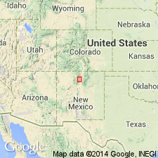
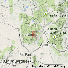
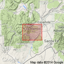
In study area, Valle Grande and Valle Toledo, in Jemez Mountains, 5 mi west of town of Los Alamos, northeast Sandoval Co, NM in the San Juan basin, oldest volcanic rocks are Chicoma volcanic formation of Smith (1938). These rocks form the complex cone of the original volcano, and are well exposed on eastern rim of caldera and the higher flanks of the volcano. Flows are conspicuously porphyritic rocks containing blocky phenocrysts of white feldspar as much as 1 inch in diameter, and some subrounded quartz phenocrysts. Groundmass is gray with bluish or purplish cast; rocks range in composition from latite to quartz latite. Interfingers with and is equivalent in age to upper part of silt, sand, and gravel deposit of Santa Fe group of middle? Miocene to Pleistocene? age that fills the Rio Grande Valley through most of NM. Is older than Bandelier rhyolite tuff of Smith (1938). Age refined from mid-Tertiary to middle Pliocene? to Pleistocene? in age.
Source: GNU records (USGS DDS-6; Denver GNULEX).
- Usage in publication:
-
- Tschicoma Formation*
- Modifications:
-
- Revised
- Age modified
- AAPG geologic province:
-
- San Juan basin
Summary:
Includes older rocks of the complex interior mass of Jemez Mountains volcanic pile. First mapped by Smith (1938) as Chicoma volcanic formation in Abiquiu quad north of Los Alamos area, Rio Arriba Co, NM in San Juan basin. Spelling revised in this report to Tschicoma, and adopted by the USGS. Consists of two mappable units. Older unit is composed of latite and quartz latite flows; the younger unit is composed of pyroxene andesite flows. Relation of Tschicoma to upper part of undifferentiated unit of Santa Fe Group and to Puye Conglomerate indicates is of Pliocene and possibly early Pleistocene age instead of Miocene age, as was assumed by earlier workers (Darton, 1928, and Bryan, 1938). Youngest part of undifferentiated unit of Santa Fe, however, is apparently middle or late Pliocene in age (Frick, 1937), and debris from Tschicoma does not extend greatly below this part of undifferentiated unit in Guaje Canyon. The pyroxene andesite unit overlying Puye probably includes some of the youngest flows of Tschicoma. These youngest flows may be of early Pleistocene age.
Source: GNU records (USGS DDS-6; Denver GNULEX).
- Usage in publication:
-
- Tschicoma Formation*
- Modifications:
-
- Revised
- Geochronologic dating
- AAPG geologic province:
-
- San Juan basin
Summary:
Revised as middle of three formations of Polvadera Group (new) in Jemez Mountains, Rio Arriba Co, NM in San Juan basin. Recent radiometric dates of 6.7 to 3.7 m.y. (written communication to author, Dalrymple, 1967) on rocks from Tschicoma Formation indicate an age of middle to late Pliocene.
Source: GNU records (USGS DDS-6; Denver GNULEX).
For more information, please contact Nancy Stamm, Geologic Names Committee Secretary.
Asterisk (*) indicates published by U.S. Geological Survey authors.
"No current usage" (†) implies that a name has been abandoned or has fallen into disuse. Former usage and, if known, replacement name given in parentheses ( ).
Slash (/) indicates name conflicts with nomenclatural guidelines (CSN, 1933; ACSN, 1961, 1970; NACSN, 1983, 2005, 2021). May be explained within brackets ([ ]).