The National Geologic Map Database is migrating to a new infrastructure. We apologize for any service disruptions during this process.
|
|---|


- Usage in publication:
-
- Tsankawi Pumice Bed*
- Modifications:
-
- Original reference
- Dominant lithology:
-
- Pumice
- AAPG geologic province:
-
- Estancia basin
- San Juan basin
Summary:
Pg. P14-P15. Tsankawi Pumice Bed of Tshirege Member of Bandelier Tuff of Tewa Group. Light-gray to white, air-fall rhyolitic pumice and ash at base of Tshirege Member; includes distinctive gray, hornblende-bearing pumice. Typically consists of 3 air-fall units (ascending): (1) lower, main unit, coarse, crudely bedded ash and pumice lapilli, 16 to 36 inches thick; (2) crystal-rich ash, 1 to 2 inches thick; and (3) medium coarse pumice and ash, 4 to 10 inches thick. Total thickness 2 to 3.5 feet in type area. Overlies Otowi Member of Bandelier Tuff or Cerro Toledo Rhyolite; underlies unnamed ash flows. Age is Pleistocene, based on radiometric age of 1.1 Ma (citing Doell and others, 1968, GSA Mem. 116, p. 211-248).
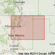
Type locality: in vicinity of Tsankawi Ruin on Pajarito Plateau, Espanola 15-min quadrangle, Los Alamos Co., north-central NM. (Pronounced tsahn-kah'-wee.)
Type area: along south side of Tsankawi Ruin mesa, in secs. 20 and 21, T. 19 N., R. 7 E., [Bandelier National Monument, White Rock 7.5-min quadrangle, Los Alamos Co.]; along Los Alamos truck route [East Jemez Road] in Sandia Canyon, in center of sec. 24, T. 19 N., R. 6 E., [Frijoles 7.5-min quadrangle, 1984 ed., Los Alamos Co.; and in roadcuts along NM Route 4 where it crosses Potrillo and Ancho Canyons, [Los Alamos National Laboratory area, White Rock and Frijoles 7.5-min quadrangles, Los Alamos Co.] (Additional locality information from USGS GNIS database, USGS historical topographic map collection TopoView; accessed December 8, 2012.)
Source: Publication; US geologic names lexicon (USGS Bull. 1520, p. 315).
- Usage in publication:
-
- Tsankawi Pumice Bed*
- Modifications:
-
- Geochronologic dating
- Age modified
- AAPG geologic province:
-
- San Juan basin
- San Luis basin
Summary:
Pg. 38 (fig. 11), 39 (table 10), 40 (table 11). Tsankawi Pumice Bed of Tshirege Member of Bandelier Tuff. Reported K-Ar ages of Doell and others (GSA Mem. 116, 1968) are recalculated using new decay constants of Steiger and Jager (1977). Age is 1.12 +/-0.03 Ma; overlying ash flows, 1.02 +/-0.04 Ma and 1.05 +/-0.04 Ma.
Notable localities in Taos SW 7.5-min quadrangle, Taos Co., and Dalles 7.5-min quadrangle, Valencia Co., north-central NM.
Source: Publication.
For more information, please contact Nancy Stamm, Geologic Names Committee Secretary.
Asterisk (*) indicates published by U.S. Geological Survey authors.
"No current usage" (†) implies that a name has been abandoned or has fallen into disuse. Former usage and, if known, replacement name given in parentheses ( ).
Slash (/) indicates name conflicts with nomenclatural guidelines (CSN, 1933; ACSN, 1961, 1970; NACSN, 1983, 2005, 2021). May be explained within brackets ([ ]).