- Usage in publication:
-
- Troy quartzite*
- Modifications:
-
- Named
- Dominant lithology:
-
- Quartzite
- AAPG geologic province:
-
- Southwestern Basin-and-Range region
Summary:
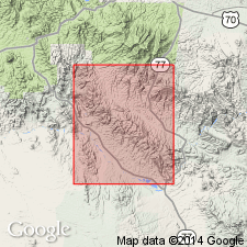
Name applied to rocks above the Mescal limestone (new) of Apache group. Troy is separated from the Mescal by a basalt flow . No type locality designated. Forms the uppermost unit of the Apache group. In earlier report on the Globe district, the quartzite and the underlying Mescal of this report were assigned to the Dripping Spring quartzite which is beneath the Mescal in the Ray area. Name Troy derived from Troy Mountain in the Dripping Spring Range, Pinal Co, AZ, Southwestern Basin-and-Range region. Averages 100 ft thick in quad. Consists of quartzite that is decomposed, vesicular, and 75 to 100 ft thick, and is yellowish to rusty, thin, flaggy to thick-bedded. Upper part is worm-marked, fine grained, shaly, and separated by beds of 1-2 inch thick olive gray shale. Thicker beds are pebbly--a feature that distinguishes Troy from the older Dripping Spring. North of Ray and Globe quads, Troy becomes a sandstone. Martin limestone conformably overlies Troy. No identifiable fossils found. Provisionally assigned a Cambrian age.
Source: GNU records (USGS DDS-6; Denver GNULEX).

- Usage in publication:
-
- Troy quartzite*
- Modifications:
-
- Revised
- AAPG geologic province:
-
- Southwestern Basin-and-Range region
Summary:
Term Troy quartzite removed as upper formation of Apache group. Troy has Middle Cambrian fossils in lower and upper beds of the same type as have been found in the Abrigo [formation]. Apache, therefore, stratigraphically restricted to unconformably underlying Mescal limestone and older rocks ([descending: Dripping Spring quartzite, Barnes conglomerate, Pioneer shale, Scanlan conglomerate]). As thus revised, Apache which is considered Algonkian bears a resemblance to the Chuar and Unkar groups of the Grand Canyon area that also are Algonkian, have an unconformity at the top, and are overlain by a quartzite with Middle and Upper Cambrian fossils. [Occurs in the Southwestern Basin-and-Range region of AZ.]
Source: GNU records (USGS DDS-6; Denver GNULEX).

- Usage in publication:
-
- Troy Quartzite*
- Modifications:
-
- Reference
- Revised
- AAPG geologic province:
-
- Southwestern Basin-and-Range region
Summary:
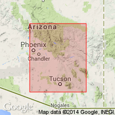
Divided into the arkose member (base), Chediski Member, and quartzite member. Detailed lithology and thickness variations given. Reference section designated and measured in secs 16, 21, and 22, T6N, R14E, where Troy is 1,198 ft thick. Southern limit of formation shown in southern Pima Co and into Graham Co, AZ in the Southwestern Basin-and-Range region. Extends northward into Yavapai Co and into adjoining Navajo Co (Southwestern Basin-and-Range region). Assigned a younger Precambrian age.
Source: GNU records (USGS DDS-6; Denver GNULEX).
For more information, please contact Nancy Stamm, Geologic Names Committee Secretary.
Asterisk (*) indicates published by U.S. Geological Survey authors.
"No current usage" (†) implies that a name has been abandoned or has fallen into disuse. Former usage and, if known, replacement name given in parentheses ( ).
Slash (/) indicates name conflicts with nomenclatural guidelines (CSN, 1933; ACSN, 1961, 1970; NACSN, 1983, 2005, 2021). May be explained within brackets ([ ]).

