The National Geologic Map Database is migrating to a new infrastructure. We apologize for any service disruptions during this process.
|
|---|


- Usage in publication:
-
- Troy granite
- Modifications:
-
- First used
- Dominant lithology:
-
- Granite
- AAPG geologic province:
-
- South Oklahoma folded belt
- Ouachita folded belt
Taylor, C.H., 1915, Granites of Oklahoma: Oklahoma Geological Survey Bulletin, no. 20, 108 p.
Summary:
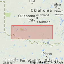
First used. Intent to name not stated; no type locality designated. Probably named for town of Troy, Johnston Co, OK, in Arbuckle Mountains district. Present on the southeastern flank of the exposed portion of the Arbuckle uplift, in Johnston Co (S. Oklahoma folded belt province) and Atoka Co (Ouachita tectonic belt province). Probably part of same intrusive body as Tishomingo granite, which is also present in this area. When unaltered, Troy is a medium- to fine-grained gray granite, speckled with black. It shows cleavage surfaces of a gray feldspar usually less than .5 mm broad, with occasionally a pinkish individual more than 1 cm across, rounded grains of colorless quartz, and many small black specks of biotite evenly distributed. There are 2 or 3 nearly vertical joint systems, spaced 2-40 ft apart, usually at right angles to each other. There are also strong sheet joints parallel or nearly parallel to the slopes of the granite hills, usually spaced 10-25 ft apart. All of the igneous rocks of the Arbuckle Mountains district are older than the Reagan sandstone which lies unconformably above them [the Reagan, according to Ulrich (1904), is Middle Cambrian]. The igneous rocks were, however, uplifted into essentially their present position during the Carboniferous, as shown by the nearly horizontal position of the post-Carboniferous rocks. Precambrian age. Geologic map.
Source: GNU records (USGS DDS-6; Denver GNULEX).
For more information, please contact Nancy Stamm, Geologic Names Committee Secretary.
Asterisk (*) indicates published by U.S. Geological Survey authors.
"No current usage" (†) implies that a name has been abandoned or has fallen into disuse. Former usage and, if known, replacement name given in parentheses ( ).
Slash (/) indicates name conflicts with nomenclatural guidelines (CSN, 1933; ACSN, 1961, 1970; NACSN, 1983, 2005, 2021). May be explained within brackets ([ ]).