

- Usage in publication:
-
- Troutdale formation
- Modifications:
-
- Named
- Dominant lithology:
-
- Gravel
- Sand
- AAPG geologic province:
-
- Columbia basin
Summary:
Named for gravels and sands deposited by ancestral Columbia River near Troutdale, Multnomah Co, OR. [no type designated]. Deposit is great piedmont fan lying on western side of Cascade zone. May be traced west to Willamette Valley and northwest into valleys of Washougal River and Canyon Creek. Composed largely of mud flows or agglomerates that contain enormous, irregular, highly vesicular, slaggy and glassy andesitic boulders. All occurrences are lens-shaped becoming thicker west of mountains and thinning west of Willamette Valley. Overlies eroded surface [Coriba Surface] of Columbia River basalt but mostly overlies Dalles formation in Columbia Gorge area. Underlies Cascan formation (new) and underlies and is intruded by andesitic lavas. Is similar in age to post-Shutler gravel stage of ancestral Columbia River, thus probably earliest Pleistocene(?) age.
Source: GNU records (USGS DDS-6; Menlo GNULEX).
- Usage in publication:
-
- Troutdale formation
- Modifications:
-
- Age modified
- Areal extent
- AAPG geologic province:
-
- Columbia basin
- Oregon-Washington Coast Ranges province
Summary:
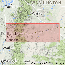
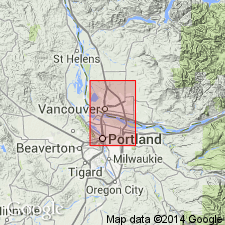
Mapped in Portland area; includes cross sections. Thickness up to 1000 ft. Unconformably underlies Boring Lava, Boring agglomerate, Pleistocene glacial outwash, and Pleistocene terrace gravels. Unconformably overlies Columbia River lava. Age is middle Pliocene based on flora.
Source: GNU records (USGS DDS-6; Menlo GNULEX).
- Usage in publication:
-
- Troutdale formation
- Modifications:
-
- Age modified
- Biostratigraphic dating
- AAPG geologic province:
-
- Columbia basin
Summary:
Age changed to early Pliocene on basis of flora collected in Sandy River drainage area on Buck Creek and near Camp Collins.
Source: GNU records (USGS DDS-6; Menlo GNULEX).
- Usage in publication:
-
- Troutdale formation
- Modifications:
-
- Age modified
- Areal extent
- Biostratigraphic dating
- AAPG geologic province:
-
- Columbia basin
- Oregon-Washington Coast Ranges province
Summary:
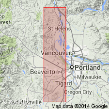
Geographically extended from near Camas, WA across Columbia River from Troutdale northwest into St. Helens quad. Mapped in St. Helens 15' quad, Cowlitz and Clark Cos, WA and Columbia Co, OR. Includes cross sections. Composed of loosely indurated sandstone, conglomerate, silt, and interbedded volcanic breccia. Unconformably underlies Quaternary alluvium and terrace sands and gravels. Unconformably overlies Columbia River basalt, Oligocene sediments, and Goble volcanic series. Fossil leaves occur in gray sandy shale in lower part of Troutdale section exposed along eastern side of HWY 99 north of Woodland, WA. Dr. E.I. Sanborn identified these species of Miocene through Pliocene ages.
Source: GNU records (USGS DDS-6; Menlo GNULEX).
- Usage in publication:
-
- Troutdale formation
- Modifications:
-
- Revised
- AAPG geologic province:
-
- Columbia basin
- Oregon-Washington Coast Ranges province
Summary:
Gravels of Troutdale had been referred by Williams (1916) to Satsop formation. The uppermost silt member of Wilkinson and others (1946) is here named Portland Hills silt member of Troutdale formation. Forms thick cover over much of Portland Hills. Silt because of its finer grain size and composition is distinct mappable unit. May be 300 ft thick near Crown Point but possibly 700 ft thick [in Portland area]. Although Troutdale is assigned Pliocene on basis of fossil flora the lowermost part may be late Miocene. Portland Hills silt member appears to be late Pliocene or even early Pleistocene age.
Source: GNU records (USGS DDS-6; Menlo GNULEX).
- Usage in publication:
-
- Troutdale formation*
- Modifications:
-
- Age modified
- AAPG geologic province:
-
- Columbia basin
- Oregon-Washington Coast Ranges province
Summary:
Extensive stratum of semiconsolidated clastic sediments of alluvial-fan type overlying Columbia River Basalt is called Troutdale formation. Mapped in Portland and Vancouver area (45 deg 15' to 46 deg N and 122 deg to 123 deg 15' W). Fills much of Tualatin Valley. Lower half consists of clay and silt; upper half includes sand and gravel layers. Unconformably underlies Boring lava. Assigned Pliocene age.
Source: GNU records (USGS DDS-6; Menlo GNULEX).
- Usage in publication:
-
- Troutdale formation*
- Modifications:
-
- Mapped
- AAPG geologic province:
-
- Columbia basin
- Oregon-Washington Coast Ranges province
Summary:
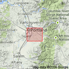
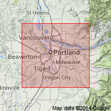
Mapped in Portland 15' quad, Clark Co, WA and Multnomah Co, OR. Basal mudstone member not exposed in quad, but probably underlies area at depth. Is more than 1100 ft thick at Mount Tabor. May be underlain by Harpers Molalla formation which is considered to be of probable middle Miocene age (R.W. Brown, pers. commun.). Underlies Boring lava and Quaternary glacial and alluvial deposits. Assigned early Pliocene age based on fossil flora (Chaney, 1944).
Source: GNU records (USGS DDS-6; Menlo GNULEX).
- Usage in publication:
-
- Troutdale Formation*
- Modifications:
-
- Revised
- Age modified
- AAPG geologic province:
-
- Western Columbia basin
- Oregon-Washington Coast Ranges province
Summary:
Name restricted to upper beds of Troutdale formation of Trimble (1957). Lower part named Sandy River Mudstone (new) in this report. Total thickness unknown but a thickness of 900 ft is inferred in area between Mount Norway and Columbia River. Troutdale formation overlies Sandy River Mudstone (new) and locally overlies Columbia River basalt. Underlies Boring lava and Quaternary deposits. Assigned early Pliocene on basis of flora (Chaney, 1944; R.W. Brown, written commun.).
Source: GNU records (USGS DDS-6; Menlo GNULEX).
- Usage in publication:
-
- Troutdale Formation*
- Modifications:
-
- Age modified
- AAPG geologic province:
-
- Columbia basin
- Oregon-Washington Coast Ranges province
Summary:
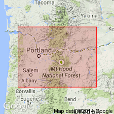
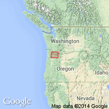
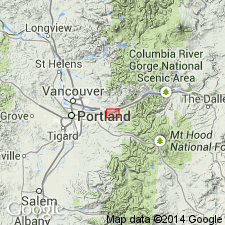
Type area shown on fig map along lower Sandy River near Troutdale, Multnomah Co, NW OR. Consists of 2 facies, ancestral Columbia River facies of fluvial conglomerates containing foreign clasts not of local origin and Cascadian stream facies containing clasts not of local origin and Cascadian stream faces containing clasts of local origin. Columbia River facies is confined to northern part of Willamette Valley. Cascadia facies is found along western flanks of Cascade Range and overlies Rhododendron Formation or Columbia River Basalt Group except in Portland Basin where overlies Sandy River Mudstone (Trimble, 1963). Deposition of unit spanned longer period than previously believed. Field evidence indicates 12 Ma beginning in Bridal Veil channel and continuing to approx. 2 Ma. [Age is considered middle and late Miocene and Pliocene; Pliocene-Pleistocene boundary placed at 1.8 Ma.]
Source: Modified from GNU records (USGS DDS-6; Menlo GNULEX).
For more information, please contact Nancy Stamm, Geologic Names Committee Secretary.
Asterisk (*) indicates published by U.S. Geological Survey authors.
"No current usage" (†) implies that a name has been abandoned or has fallen into disuse. Former usage and, if known, replacement name given in parentheses ( ).
Slash (/) indicates name conflicts with nomenclatural guidelines (CSN, 1933; ACSN, 1961, 1970; NACSN, 1983, 2005, 2021). May be explained within brackets ([ ]).