The National Geologic Map Database is migrating to a new infrastructure. We apologize for any service disruptions during this process.
|
|---|


- Usage in publication:
-
- Trinidad sandstone*
- Modifications:
-
- Contact revised
- AAPG geologic province:
-
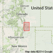
- Las Vegas-Raton basin
Summary:
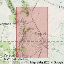
Upper contact revised in that the Trinidad underlies newly named Vermejo formation. Rocks assigned to the Vermejo in this report were included by Hayden (1869) in the lower part of his Raton Hills group. Lower contact revised in that Trinidad is limited to the "Upper Trinidad" of Hills (1899). The "Lower Trinidad" is a 75 ft thick unit that is transitional with and therefore placed in the underlying Pierre shale. As revised, the Trinidad is a massive, cliff-making, feldspathic sandstone 70 to 100+ ft thick. Cross section. Is a single sandstone mass at some localities and two sandstones at other localities. Recognized as a persistent feature in the coal field in Las Animas Co, CO and adjoining Colfax Co, NM in the Las Vegas-Raton basin. Stratigraphic table. Fossils (invertebrates, fish) listed. Probably a correlative of the Fox Hills sandstone. Considered to be late Montana, Late Cretaceous age.
Source: GNU records (USGS DDS-6; Denver GNULEX).
- Usage in publication:
-
- Trinidad sandstone*
- Modifications:
-
- Areal extent
- AAPG geologic province:
-
- Las Vegas-Raton basin
Summary:
Includes an isopach map (fig. 4) of the Late Cretaceous Trinidad sandstone for the area south of Walsenburg, CO and north of Cimarron, NM in the Las Vegas-Raton basin.
Source: GNU records (USGS DDS-6; Denver GNULEX).
For more information, please contact Nancy Stamm, Geologic Names Committee Secretary.
Asterisk (*) indicates published by U.S. Geological Survey authors.
"No current usage" (†) implies that a name has been abandoned or has fallen into disuse. Former usage and, if known, replacement name given in parentheses ( ).
Slash (/) indicates name conflicts with nomenclatural guidelines (CSN, 1933; ACSN, 1961, 1970; NACSN, 1983, 2005, 2021). May be explained within brackets ([ ]).