

- Usage in publication:
-
- Tres Hermanos sandstone
- Modifications:
-
- Original references
- Dominant lithology:
-
- Sandstone
- AAPG geologic province:
-
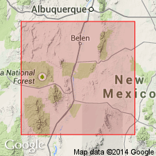
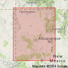
- Orogrande basin
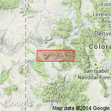
- San Juan basin
Summary:
Pg. 331-346; C.L. Herrick and D.W. Johnson, 1900, New Mexico Univ. Bull., v. 2, pt. 1, p. 3-63, pt. 2, p. 1-17. Tres Hermanos sandstone. Massive yellow sandstone, 75 feet thick. Lies 225+ feet lower than Punta de la Mesa sandstone and 100+ feet bellow the cephalopod zone. Is separated from underlying gastropod zone (containing Benton fossils) by 100 feet of yellow shale. Lies 150 to 250 feet above Dakota sandstone. [Age is Late Cretaceous.]
[Origin of name not stated. See also entry under Dane (1959).]
Source: US geologic names lexicons (USGS Bull. 896, p. 2181-2182; USGS Bull. 1200, p. 3952-3953).
- Usage in publication:
-
- Tres Hermanos sandstone member*
- Modifications:
-
- Revised
- AAPG geologic province:
-
- Estancia basin
Summary:
Pg. 592-598. Tres Hermanos sandstone member of Mancos shale. Lies lower than and in close association with the concretion (SEPTARIA) zone and higher than the gastropod zone of previous reports. It is typically developed in Rio Puerco field, but is readily recognized in Tijeras, Hagan, and Cerrillos fields, and is probably represented throughout San Juan basin. It consists of a series of yellow sandstones 150+/- feet thick on Rio Puerco and thinner in some other fields. It thickens westward and thins to east. The name may be used to designate the zone of yellow sandstone that occurs near base of Mancos shale in all the fields described in central New Mexico west of the mountains. [Age is Late Cretaceous.]
Source: US geologic names lexicon (USGS Bull. 896, p. 2181-2182).
- Usage in publication:
-
- Tres Hermanos sandstone member*
- Modifications:
-
- Areal extent
- AAPG geologic province:
-
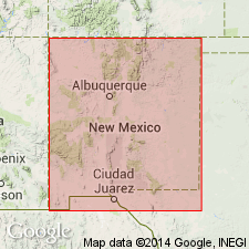
- Orogrande basin
Summary:
July 12, 1915, p. 45. Near base of Mancos shale is Tres Hermanos sandstone member, which is recognizable from Datil Mountains to Casa Salazar but not found farther north, near Gallina. This sandstone is coal-bearing in Datil Mountains, but in Rio Puerco field only a single layer of carbonaceous shale was found in it. [Age is Late Cretaceous.]
Source: US geologic names lexicon (USGS Bull. 896, p. 2181-2182).
- Usage in publication:
-
- Tres Hermanos sandstone member*
- Modifications:
-
- Areal extent
- AAPG geologic province:
-
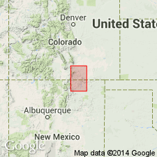
- Las Vegas-Raton basin
Summary:
Pg. 172, 174, 179, 199, 203, 213-214. Tres Hermanos sandstone member of Mancos shale. Lies 1,147 feet below Punta de la Mesa sandstone at Casa Salazar. At its type locality it is 20 feet thick and consists of thin irregular layers of sandstone an inch or less thick, on whose faces are ripple marks, worm tracks, and markings of many kinds; the sandy layers are separated in some places by films of shale; a few imperfect casts of gastropods were found in it, and impressions supposed to be HALYMENITES MAJOR are abundant in some places. The sandstone is unlike any other rocks near it and has a peculiar appearance that makes it recognition easy. About 100 feet above it is a small ridge of limestone 3+/- feet thick, which presumably represents Greenhorn limestone. In Hagan field the Tres Hermanos is only 5 feet thick, but increases to 15 or 20 feet nearby. Near Rogers, 2 miles southwest of Cerrillos, it is 20 feet thick and consists of hard quartzose sandstone, in thin irregular layers and weathers yellowish brown. In Tijeras coal field it is 145 feet thick and consists of hard quartzose sandstone containing worm borings and indefinite markings of various kinds. [Age is Late Cretaceous.]
Source: US geologic names lexicon (USGS Bull. 896, p. 2181-2182).
- Usage in publication:
-
- Tres Hermanos Sandstone*
- Modifications:
-
- Areal extent
- AAPG geologic province:
-
- Orogrande basin
Summary:
Correlations of earlier workers of several sandstones in the Mount Taylor area above the Dakota Sandstone with the Tres Hermanos Sandstone of Herrick (1900) were in error. The sandstone of western New Mexico above the Dakota and below the GRYPHAEA NEWBERRYI sandstone bed of the Mancos Shale is the Twowells Sandstone Tongue of the Dakota. The Twowells has a molluscan fauna of the same age as the Hartland Shale Member of the Greenhorn Limestone. The Tres Hermanos Sandstone of Herrick of central NM has a fauna of early Carlile age and is therefore younger than the Twowells. Pike in 1947 is thought to have correctly identified the type locality of the Tres Hermanos as "probably a mile east of Tres Hermanos Peaks...in sec 26, T3N, R7W." Tres Hermanos is represented in northwest NM and southwest CO by a unit composed of silty shale and green-gray siltstone that contains COLLIGNONICERAS WOOLLGARI. Tres Hermanos is present in the Rio Salado Valley, Carthage coal field, and near Socorro, Socorro Co, NM in the Orogrande basin.
Source: GNU records (USGS DDS-6; Denver GNULEX).
- Usage in publication:
-
- Tres Hermanos Sandstone Member
- Modifications:
-
- Not used
- AAPG geologic province:
-
- San Juan basin
Summary:
A prominent, fine- to medium-grained sandstone with brown concretionary masses lies about 80 ft above the base of the Mancos Shale in the Gallup area, NM in the San Juan basin. This sandstone is 44 ft thick and it is capped by a coquina 5 ft thick of GRYPHAEA NEWBERRYI. This 49 ft unit has been called Tres Hermanos Sandstone Member of Mancos by several authors. The sandstone extends eastward along Mesa de los Lobos toward Mount Taylor and McCarty area. Fossils identified show the "type" Tres Hermanos [in Valencia Co, NM, San Juan basin] is of Carlile age, rather than Greenhorn as previously thought. GRYPHAEA-bearing sandstone east of Gallup previously called Tres Hermanos is probably the Twowells Sandstone Lentil of the Dakota. Term Tres Hermanos not used in Gallup area.
Source: GNU records (USGS DDS-6; Denver GNULEX).
- Usage in publication:
-
- Tres Hermanos Formation*
- Modifications:
-
- Principal reference
- Revised
- Reference
- AAPG geologic province:
-
- Orogrande basin
- San Juan basin
Summary:
Removed from Mancos Shale as a member, raised in stratigraphic rank to formation. Divided into: Atarque Sandstone Member, a regressive marine sandstone, at base; Carthage Member, a marine to nonmarine shale and sandstone, in middle; and Fite Ranch Member, a transgressive marine sandstone, at top--all new names. Outcrop belt in Ts2 and 3N, Rs5 and 6W, Socorro Co, Orogrande basin designated the type area. Principal reference section designated and measured in secs 8 and 17, T5S, R2E, Socorro Co. Reference sections selected and measured in NW1/4 sec 6, T2N, R5W, Socorro Co and in NW1/4 NE1/4 sec 5, T10N, R17W, McKinley Co, San Juan basin. Ranges in thickness from 200 to 300 ft (61-91 m). Overlies Rio Salado Tongue of Mancos; underlies Pescado Tongue or D-Cross Tongue of Mancos. Tongues into main body of Mancos (complex relationships shown on figures). Ranges from late early to late Turonian, Late Cretaceous age. Correlates with lower part of Moreno Hill Formation of Fence Lake area. Recognized from Atarque to Carthage.
Source: GNU records (USGS DDS-6; Denver GNULEX).
- Usage in publication:
-
- Tres Hermanos Formation*
- Modifications:
-
- Biostratigraphic dating
- AAPG geologic province:
-
- San Juan basin
Summary:
Basal part of formation is assigned a middle Turonian (Late Cretaceous) age based on presence of ammonite SPATHITES COAHUILAENSIS from USGS Mesozoic locality D10320, Cibola Co, NM in the San Juan basin.
Source: GNU records (USGS DDS-6; Denver GNULEX).
- Usage in publication:
-
- Tres Hermanos Formation
- Modifications:
-
- Biostratigraphic dating
- Overview
- AAPG geologic province:
-
- San Juan basin
Summary:
Is formation characterized as a northeastward-directed wedge of clastic rocks that overlies the Rio Salado Tongue of the Mancos Shale in the San Juan basin in west-central NM. Comprised of 3 members (ascending): Atarque Sandstone Member, Carthage Member, and Fite Ranch Sandstone Member. Overlain by Pescado Tongue of Mancos Shale in Upper Nutria area, and by D-Cross Tongue of Mancos in Acoma Pueblo area. Molluscan fossils are locally abundant in the Atarque Member. Tres Hermanos ranges in age from early middle Turonian to early late Turonian (ammonite zones of COLLIGNONICERAS WOOLLGARI, PRIONOCYCLUS PERCARINATUS, P. HYATTI, and P. MACOMBI). Figure 2 is stratigraphic nomenclature and correlation chart of middle Cenomanian to lower Coniacian rocks in west-central NM, spanning 20 ammonite zones.
Source: GNU records (USGS DDS-6; Denver GNULEX).
For more information, please contact Nancy Stamm, Geologic Names Committee Secretary.
Asterisk (*) indicates published by U.S. Geological Survey authors.
"No current usage" (†) implies that a name has been abandoned or has fallen into disuse. Former usage and, if known, replacement name given in parentheses ( ).
Slash (/) indicates name conflicts with nomenclatural guidelines (CSN, 1933; ACSN, 1961, 1970; NACSN, 1983, 2005, 2021). May be explained within brackets ([ ]).