

- Usage in publication:
-
- Trapper Tonalite*
- Modifications:
-
- Named
- Dominant lithology:
-
- Tonalite
- AAPG geologic province:
-
- Montana folded belt
Summary:
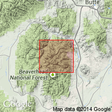
Named for Trapper Creek, Beaverhead Co, MT in Montana folded belt province. Type locality designated on south slope of Trapper Creek, north of Granite Lake in the central part of the Vipond Park quad. Cut by Grayling Lake Granite (new). Consists of medium-grained, dark-gray tonalite. Cuts Keokirk Quartz Diorite (new). Is one of five plutonic units of Pioneer batholith. Assigned to the Late Cretaceous. Has K-Ar ages on biotite of 71.9 +/-4.3 to 74.3 +/-2.7 m.y.
Source: GNU records (USGS DDS-6; Denver GNULEX).
For more information, please contact Nancy Stamm, Geologic Names Committee Secretary.
Asterisk (*) indicates published by U.S. Geological Survey authors.
"No current usage" (†) implies that a name has been abandoned or has fallen into disuse. Former usage and, if known, replacement name given in parentheses ( ).
Slash (/) indicates name conflicts with nomenclatural guidelines (CSN, 1933; ACSN, 1961, 1970; NACSN, 1983, 2005, 2021). May be explained within brackets ([ ]).