

- Usage in publication:
-
- Trail Canyon Limestone
- Modifications:
-
- Named
- Dominant lithology:
-
- Limestone
- AAPG geologic province:
-
- Snake River basin
- Great Basin province
Summary:
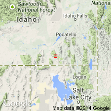
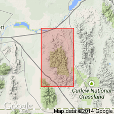
Named for exposures (the type section) along the divide of Sublett Range between Tussing Canyon in NW1/4 sec 22 and the head of Trail Canyon in SW1/4 sec 26, T12S, R30E, Power Co, ID in Snake River basin. Extends into Oneida Co, ID in Great Basin province. Consists of various types of limestone--sandy, bioclastic, coarsely crystalline, finely crystalline to lithographic, mostly dark blue or dark gray. Chert occurs as nodules, stringers, and beds. Is 4,200 ft thick in sec 26. Overlies Tussing Sandstone and underlies Heydlauff Sandstone (both new names). Is very fossiliferous (fusulinids, crinoids, corals); is thought to be early and middle Leonardian, or Early Permian. Type measured section. Graphic sections.
Source: GNU records (USGS DDS-6; Denver GNULEX).
- Usage in publication:
-
- Trail Canyon Formation
- Modifications:
-
- Redescribed
- Revised
- AAPG geologic province:
-
- Great Basin province
Summary:
Name changed from Trail Canyon Limestone to Trail Canyon Formation and assigned as 1 of 5 formations of the Oquirrh Group in Cassia and Oneida Cos, ID in the Great Basin province. Is predominantly limestone, but includes bedded chert and sandstone. Divisible into lower unit of interbedded sandstone and limestone 360 m thick; a lower middle unit of ledge-forming limestone and subordinate sandstone and minor chert 400 m thick; an upper middle unit of interbedded sandstone and limestone 650 m thick; and an upper unit of bedded chert and sandstone with minor limestone about 100 m thick. Upper unit is very fossiliferous. Two middle units form prominent ledges. Nearly all the limestone in the formation contains 15 to 20 percent quartz grains of fine sand or coarse silt size. Lower boundary with Tussing Formation, newly assigned to Oquirrh, revised to include some rocks formerly in Tussing. Overlain by Hudspeth Cutoff Formation, newly assigned to Oquirrh. Fusulinids (listed). Of Late Pennsylvanian, Virgilian and Early Permian, Wolfcampian age identified. Nomenclature chart. Geologic map. Columnar section. Includes rocks formerly called Indian Trail Member of Wells Formation. Indian Trail abandoned. Wells not used.
Source: GNU records (USGS DDS-6; Denver GNULEX).
For more information, please contact Nancy Stamm, Geologic Names Committee Secretary.
Asterisk (*) indicates published by U.S. Geological Survey authors.
"No current usage" (†) implies that a name has been abandoned or has fallen into disuse. Former usage and, if known, replacement name given in parentheses ( ).
Slash (/) indicates name conflicts with nomenclatural guidelines (CSN, 1933; ACSN, 1961, 1970; NACSN, 1983, 2005, 2021). May be explained within brackets ([ ]).