The National Geologic Map Database is migrating to a new infrastructure. We apologize for any service disruptions during this process.
|
|---|


- Usage in publication:
-
- Trafalgar formation
- Modifications:
-
- First used
- AAPG geologic province:
-
- Illinois basin
Summary:
First use of name on diagram of Pleistocene age in Indiana. Name appears above Jessup formation and below Lagro formation (both new). Name credited to W.J. Wayne (in prep).
Source: GNU records (USGS DDS-6; Reston GNULEX).
- Usage in publication:
-
- Trafalgar Formation
- Modifications:
-
- Named
- Dominant lithology:
-
- Conglomerate
- Mudstone
- Till
- Silt
- AAPG geologic province:
-
- Illinois basin
Summary:
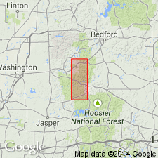
Name Trafalgar Formation formally proposed for Pleistocene unit exposed along Buckhart Creek in south-central IN. Composed primarily of calcareous conglomeratic mudstone, a compact but uncemented sandy, silty matrix that contains fairly abundant pebbles and cobbles. Contains scattered beds and lenses of silt, sand, and gravel. Thickness as much as 24.5 ft at type section. Includes (ascending) Center Grove Till Member and Cartersburg Till Member (both new). Members are separated by thin fossiliferous silt bed referred to as VERTIGO ALPESTRIS OUGHTONI beds. Overlies Lagro Formation; underlies Jessup Formation. Sediments included in Trafalgar have been correlated, in part at least, with sediments of Tazewell Substage and are included in lower part of Woodfordian Substage of Frye and Willman's (1960) classification.
Source: GNU records (USGS DDS-6; Reston GNULEX).
- Usage in publication:
-
- Trafalgar Formation
- Modifications:
-
- Revised
- AAPG geologic province:
-
- Illinois basin
Summary:
Trafalgar Formation in west-central IN, here stratigraphically extended to include unnamed till resembling Batestown Till Member of Wedron in IL. Unit described as yellow-brown to gray till, loam, soil, and loess. Overlies Snider Till Member of Wedron Formation, here extended from IL.
Source: GNU records (USGS DDS-6; Reston GNULEX).
For more information, please contact Nancy Stamm, Geologic Names Committee Secretary.
Asterisk (*) indicates published by U.S. Geological Survey authors.
"No current usage" (†) implies that a name has been abandoned or has fallen into disuse. Former usage and, if known, replacement name given in parentheses ( ).
Slash (/) indicates name conflicts with nomenclatural guidelines (CSN, 1933; ACSN, 1961, 1970; NACSN, 1983, 2005, 2021). May be explained within brackets ([ ]).