The National Geologic Map Database is migrating to a new infrastructure. We apologize for any service disruptions during this process.
|
|---|


- Usage in publication:
-
- Trace Creek Shale Member*
- Modifications:
-
- Named
- Dominant lithology:
-
- Siltstone
- Claystone
- AAPG geologic province:
-
- Arkoma basin
Summary:
Pg. D43-D44. Trace Creek Shale Member of Bloyd Shale. Composed of marine dark-gray to black shaly siltstone and claystone with minor local thin calcareous zones and limestone or calcareous sandstone lenses. Thickness commonly 60 to 70 feet; 125 feet near southwest corner of Washington County. Locally intergrades with underlying Kessler Limestone Member; underlies Greenland Sandstone Member of Atoka Formation. Age is Early Pennsylvanian (Morrow).
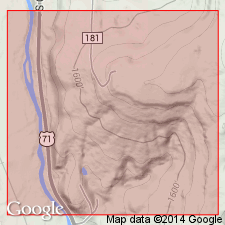
Type locality: southwest part of Bloyd Mountain from center of E/2 sec. 3 to center of north side sec. 4, T. 14 N., R. 30 W., Washington Co., northwestern AR. Named from Trace Creek.
Source: US geologic names lexicon (USGS Bull. 1350, p. 770).
For more information, please contact Nancy Stamm, Geologic Names Committee Secretary.
Asterisk (*) indicates published by U.S. Geological Survey authors.
"No current usage" (†) implies that a name has been abandoned or has fallen into disuse. Former usage and, if known, replacement name given in parentheses ( ).
Slash (/) indicates name conflicts with nomenclatural guidelines (CSN, 1933; ACSN, 1961, 1970; NACSN, 1983, 2005, 2021). May be explained within brackets ([ ]).