- Usage in publication:
-
- Toreva formation*
- Modifications:
-
- Named
- Dominant lithology:
-
- Sandstone
- Mudstone
- Siltstone
- AAPG geologic province:
-
- Black Mesa basin
Summary:
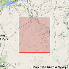
Named as lower formation of Upper Cretaceous Mesaverde group for town of Toreva, Navajo Co, AZ, Black Mesa basin. Type locality measured 1.3 mi northwest of Toreva, southern part of Black Mesa. Divisible into: 1) lower sandstone member --light-brown to yellowish-gray, fine- to medium-grained quartz sandstone containing mica as a secondary mineral, 128 ft thick; 2) middle carbonaceous member--of alternating flat- and thinly bedded carbonaceous mudstone, varicolored siltstone, coal, and lenses of yellow-gray, fine- to coarse-grained. poorly sorted, cross-bedded quartz sandstone; mica common in sandstone and siltstone, 106 ft thick, and 3) upper sandstone member--a yellow-gray to buff, very coarse to fine-grained sandstone that has subround to subangular, poorly, sorted quartz grains and clay pebbles 79 ft thick. Middle member disappears to north. Only lower member of three members on northeast side of mesa is correlative with Toreva to south. Ranges from 141 ft thick at Lohali Point to 325 ft thick at Yale Point. Overlies Mancos shale; underlies Wepo formation (new) of Mesaverde. Niobrara age fossils in marine shale tongue in northeast part of mesa. Is of Carlile age at type. Correlative of Juana Lopez member, lower Gallup sandstone, Ferron sandstone member, basal Funk Valley formation, and Straight Cliffs sandstone. Upper part of Toreva in north part of mesa correlative of upper Gallup, Mulatto tongue, and Dalton sandstone member.
Source: GNU records (USGS DDS-6; Denver GNULEX).

- Usage in publication:
-
- Toreva Formation*
- Modifications:
-
- Revised
- Overview
- AAPG geologic province:
-
- Black Mesa basin
Summary:
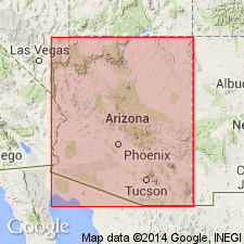
Interpretation of areal extent of the lower sandstone, middle carbonaceous, and upper sandstone members of the Toreva as they are recognized at the type locality near Black Mesa northward on the mesa is modified. The middle carbonaceous member pinches out northward; only outliers of it are known at the north end of the mesa. The middle carbonaceous-upper sandstone member contact is unconformable. Rocks called main ledge, marine shale and upper sandstone, in part equivalent to, and in part younger than, any Wepo at the type, are removed in part from the Wepo. The marine mudstone, siltstone, and sandstone sequence is named Wind Rock Tongue of Mancos Shale. The overlying sandstone is named Rough Rock Sandstone of Mesaverde Group. The remaining part of the Toreva at the north end of the mesa are assigned to the Wepo Formation. Atarque Sandstone Member of Tres Hermanos, Pescado Tongue of Mancos Shale, Tibbet Canyon Member of Straight Cliffs Formation, and Emery Sandstone Member of Mancos are equivalent to the lower sandstone member of Toreva.
Source: GNU records (USGS DDS-6; Denver GNULEX).

- Usage in publication:
-
- Toreva Formation
- Modifications:
-
- Biostratigraphic dating
- Revised
- AAPG geologic province:
-
- Plateau sedimentary province
- Black Mesa basin
Summary:
Blue Point Tongue is formally named as a lower tongue of the Upper Cretaceous Toreva Formation in southwestern part of Black Mesa basin, easternmost Coconino Co, AZ (Plateau sedimentary province). Intertongues with upper shale member of Mancos Shale. Blue Point Tongue and lower sandstone member of Toreva are assigned to middle Turonian COLLIGNONICERAS WOOLLGARI REGULARE subzone at Blue Point. Lower sandstone member of Toreva assigned to middle Turonian PRIONOCYCLUS HYATTI Zone in vicinity of Lohali Point, Apache Co, AZ (Black Mesa basin). Main body of Toreva gradationally overlies Mancos. Transition zone from Mancos to Toreva is 5-20 m thick; grades from dark shale interbedded with siltstone, mudstone, and thin beds of very fine-grained sandstone to mudstone and soft bioturbated, argillaceous sandstone interbedded with very fine sandstone, siltstone, and dark shale; fine plant debris common along bedding planes.
Source: GNU records (USGS DDS-6; Denver GNULEX).
For more information, please contact Nancy Stamm, Geologic Names Committee Secretary.
Asterisk (*) indicates published by U.S. Geological Survey authors.
"No current usage" (†) implies that a name has been abandoned or has fallen into disuse. Former usage and, if known, replacement name given in parentheses ( ).
Slash (/) indicates name conflicts with nomenclatural guidelines (CSN, 1933; ACSN, 1961, 1970; NACSN, 1983, 2005, 2021). May be explained within brackets ([ ]).

