- Usage in publication:
-
- Tordrillo series*
- Modifications:
-
- Named
- Dominant lithology:
-
- Shale
- Sandstone
- Limestone
- AAPG geologic province:
-
- Alaska Southwestern region
Summary:
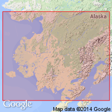
[Probably named for Tordrillo Mountains, Alaska Range, southwestern AK.] First noted near junction of Skwentna with Happy River. Unit occurs in Lower Happy River Valley, along Skwentna to mouth of Portage Creek, in Ptarmigan Valley, in Teocalli Mountains, and in Kuskokwim Valley between Teocalli Mountains and Terra Cotta Mountains. Consists of considerable thickness of black shales, often carbonaceous, intercalated with many beds of sandstone, arkose, and impure limestones. Contains imperfect plant remains. Is highly folded and cut through by intrusives. Overlies Skwentna series (new) on east side of Tordrillo Mountains; conformably overlies Terra Cotta series (new) on west side. Map legend gives age as Cretaceous(?).
Source: GNU records (USGS DDS-6; Menlo GNULEX).

- Usage in publication:
-
- Tordrillo formation*
- Modifications:
-
- Revised
- Age modified
- Biostratigraphic dating
- AAPG geologic province:
-
- Alaska Southwestern region
Summary:
Tordrillo series of Spurr (1900) is revised [reduced in rank] and referred to as Tordrillo formation. Occupies belt 25 to 30 mi wide in heart of Alaska Range. Unit described as conglomerates, grits, sandstone, slates with some limestone on map legend of geologic reconnaissance map of Mount McKinley region. Is probably between 2000 and 3000 ft thick. Unconformably overlies Tonzona group (new) on the west. Overlies Skwentna group along Skwentna River. Age is Middle Jurassic based on INOCERAMUS EXIMIUS Eichwald identified by T.W. Stanton (written commun., 1905).
Source: GNU records (USGS DDS-6; Menlo GNULEX).
For more information, please contact Nancy Stamm, Geologic Names Committee Secretary.
Asterisk (*) indicates published by U.S. Geological Survey authors.
"No current usage" (†) implies that a name has been abandoned or has fallen into disuse. Former usage and, if known, replacement name given in parentheses ( ).
Slash (/) indicates name conflicts with nomenclatural guidelines (CSN, 1933; ACSN, 1961, 1970; NACSN, 1983, 2005, 2021). May be explained within brackets ([ ]).

