

- Usage in publication:
-
- Topagoruk member*
- Modifications:
-
- Named
- Biostratigraphic dating
- Dominant lithology:
-
- Shale
- Siltstone
- Sandstone
- AAPG geologic province:
-
- Alaska Northern region
Summary:
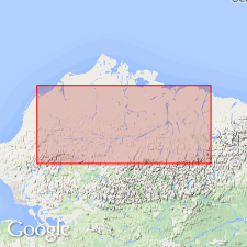
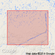
Topagoruk member named as upper member of Umiat formation (new) of Nanushuk group (new) from section in Topagoruk Test Well No.1 from 50 to about 3100 ft depth, at 70 deg 37'30"N, 155 deg 33'36"W, approximately 72 mi S 14 deg E of Point Barrow, northern AK. Upper part (1000 ft thick) consists of coal, shale, sandstone and minor amounts of ironstone. Lower part (2100 ft thick) consists of marine clay shale, silt shale, silt, and sandstone. Thickens southward and intertongues with Hatbox and Niakogon tongues (both new) of Chandler formation (new) of Nanushuk group. Overlies Tuktu member (new) of Umiat formation of Nanushuk group; underlies Seabee member (new) of Schrader Bluff formation (new). Though age not definitely established fossils suggest Early(?) Cretaceous age.
Source: GNU records (USGS DDS-6; Menlo GNULEX).
- Usage in publication:
-
- Topagoruk formation*
- Modifications:
-
- Revised
- Biostratigraphic dating
- AAPG geologic province:
-
- Alaska Northern region
Summary:
Topagoruk member of Umiat formation of Gryc and others (1951) is raised in rank to Topagoruk formation. Measured type section redefined as extending from 1350 to 3900 ft depth in Topagoruk test well No.1. [Umiat formation is abandoned]. Consists primarily of medium gray to medium dark gray clay shale with thin beds and laminae of medium gray siltstone although uppermost 800 ft also contain thin beds of very argillaceous, very fine-grained sandstone. Overlies with slight angular unconformity Oumalik formation (new). Conformably underlies Grandstand formation. Microfossils and megafossils listed. Age given as Early Cretaceous.
Source: GNU records (USGS DDS-6; Menlo GNULEX).
- Usage in publication:
-
- Topagoruk formation
- Modifications:
-
- Not used
- AAPG geologic province:
-
- Alaska Northern region
Summary:
Although Tuktu formation, lithologically, more closely resembles Topagoruk formation of Robinson and others (1956) than it does Tuktu formation of its type section, these rocks in Grandstand test well No.1 are designated Tuktu formation only for continuity with field geology.
Source: GNU records (USGS DDS-6; Menlo GNULEX).
- Usage in publication:
-
- Topagoruk formation*
- Modifications:
-
- Areal extent
- AAPG geologic province:
-
- Alaska Northern region
Summary:
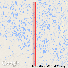
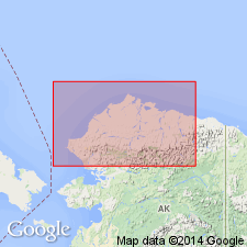
520 ft of Topagoruk formation are penetrated by Titaluk test well No.1 from 3500 to 4020 ft depth, at 69 deg 25'21"N, 154 deg 34'04"W, on Titaluk anticline about 62 mi west of Umiat, northern AK.
Source: GNU records (USGS DDS-6; Menlo GNULEX).
- Usage in publication:
-
- Topagoruk formation
- Modifications:
-
- Not used
- AAPG geologic province:
-
- Alaska Northern region
Summary:
In area of Umiat-Maybe Creek region rocks equivalent to Topagoruk Formation are included in Torok Formation.
Source: GNU records (USGS DDS-6; Menlo GNULEX).
- Usage in publication:
-
- Topagoruk Formation†
- Modifications:
-
- Abandoned
- AAPG geologic province:
-
- Alaska Northern region
Summary:
Topagoruk Formation abandoned, its rocks considered part of transition zone between Torok Formation and Nanushuk Group.
Source: GNU records (USGS DDS-6; Menlo GNULEX).
For more information, please contact Nancy Stamm, Geologic Names Committee Secretary.
Asterisk (*) indicates published by U.S. Geological Survey authors.
"No current usage" (†) implies that a name has been abandoned or has fallen into disuse. Former usage and, if known, replacement name given in parentheses ( ).
Slash (/) indicates name conflicts with nomenclatural guidelines (CSN, 1933; ACSN, 1961, 1970; NACSN, 1983, 2005, 2021). May be explained within brackets ([ ]).