- Usage in publication:
-
- Tonto group*
- Modifications:
-
- Original reference
- Dominant lithology:
-
- Sandstone
- AAPG geologic province:
-
- Plateau sedimentary province
Summary:
Tonto sandstones. A group of rocks exposed in the Grand Canon of the Colorado, and locally designated as the Tonto group. Full description will appear in Wheeler Report.
Source: US geologic names lexicon (USGS Bull. 896, p. 2164-2165).
- Usage in publication:
-
- Tonto group*
- Modifications:
-
- Original reference
- Dominant lithology:
-
- Sandstone
- Shale
- Limestone
- AAPG geologic province:
-
- Plateau sedimentary province
Summary:
Pg. 60, 171-186, fig. 82. Tonto group. Consists of (descending): marbled limestone (mottled limestone), 75 to 200 feet; Tonto shale (arenaceous and argillaceous shales), 600 feet; Tonto sandstone (vitreous sandstone), 80 feet. Unconformably overlies Archean crystalline schists and granites and underlies Redwall limestone group in Grand Canyon. Tonto group floors the valleys that contain the headwaters of Big Williams Fork of the Colorado and of the Verde and Tonto Creeks, tributaties of Salt River, [Coconino and Mohave Counties], Arizona. Age is Middle Cambrian.
[GNC remark (ca. 1938, US geologic names lexicon, USGS Bull. 896, p. 2165): The "Marbled limestone" is now known as Muav limestone, the "Tonto shale" as Bright Angel shale, and the "Tonto sandstone" as Tapeats sandstone.]
Source: US geologic names lexicon (USGS Bull. 896, p. 2164-2165).
- Usage in publication:
-
- Tonto group*
- Modifications:
-
- Revised
- AAPG geologic province:
-
- Plateau sedimentary province
Summary:
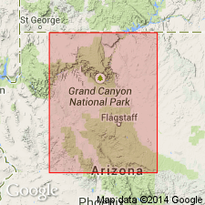
Tonto group. In Shinumo quadrangle, Coconino County, northern Arizona, divided into 3 newly named formations (ascending) Tapeats sandstone, Bright Angel shale, and Muav limestone. Thickness up to 1,135 feet. Unconformably overlies ("great unconformity") Dox sandstone. Unconformably underlies Redwall limestone. Tapeats correlative with: Apache group of Globe area, Arizona; Coronado quartzite of Clifton district, Arizona; and Bolsa quartzite of Bisbee district, Arizona. Bright Angel and Muav correlative with Abrigo limestone of Bisbee area. Age is Middle Cambrian. Report includes geologic map.
Source: Modified from GNU records (USGS DDS-6; Denver GNULEX).
- Usage in publication:
-
- Tonto group
- Modifications:
-
- Revised
- AAPG geologic province:
-
- Plateau sedimentary province
Summary:
Tonto group. Includes Lower Cambrian Tapeats sandstone, Lower and Middle Cambrian Bright Angel shale, and Middle Cambrian Muav limestone (restricted). Bright Angel and Muav intertongue. In various places, unconformably overlies Precambrian Vishnu schist, Archean granite, Archean schist, or Dox sandstone. Fossils (trilobites, brachiopods) described. Measured sections along Grand Canyon, Mohave and Coconino Counties, Arizona.
Source: Modified from GNU records (USGS DDS-6; Denver GNULEX).
- Usage in publication:
-
- Tonto Group*
- Modifications:
-
- Not used
Summary:
Tonto Group not used in report. Lower formation of Tonto, the Tapeats Sandstone, revised in that upper unit of Tapeats of earlier reports removed and assigned to the newly named Chino Valley Formation. Former upper unit of Tapeats recognized between Partridge Creek southeast in the Chino Valley and south to the Jerome area, Yavapai Co, AZ in the Basin-and-Range province, an area of about 75 km. Stratigraphic diagrams.
Source: GNU records (USGS DDS-6; Denver GNULEX).
- Usage in publication:
-
- Tonto Group*
- Modifications:
-
- Revised
- AAPG geologic province:
-
- Plateau sedimentary province
Summary:
Pg. 2 (fig. 1.1), 8-9, 10 (fig. 1.11), 11 (fig. 1.12). The uppermost dolomite beds originally included in uppermost formation (Muav Limestone) of Tonto Group [by Noble, 1914, USGS Bull. 549] are excluded and called Cambrian unclassified dolomite. The unclassified dolomite may correlate with dolomite underlying the Dunderberg Shale Member of Nopah Formation (Upper Cambrian) exposed along U.S. Route I-10 in Virgin River Gorge, [Mohave County], northwestern Arizona. Report includes a schematic section (fig. 1.1).
[GNC remark (April 2023): This "unclassified dolomite" is now known as Frenchman Mountain Dolostone of Tonto Group. See Frenchman Mountain.]
Source: Publication.
- Usage in publication:
-
- Tonto Group
- Modifications:
-
- Principal reference
Rose, E.C., 2011, Proposed modification of the nomenclature and a revised depositional model for the Cambrian Tonto Group of the Grand Canyon, Arizona: Museum of Northern Arizona Bulletin, Flagstaff, AZ, and southern NV, June 12-20, 2011, no. 67, p. 77-98., 16th field conference of the Cambrian Stage Subdivision Working Group, International Subcommission on Cambrian Stratigraphy
Summary:
aaa
Source: aaa
For more information, please contact Nancy Stamm, Geologic Names Committee Secretary.
Asterisk (*) indicates published by U.S. Geological Survey authors.
"No current usage" (†) implies that a name has been abandoned or has fallen into disuse. Former usage and, if known, replacement name given in parentheses ( ).
Slash (/) indicates name conflicts with nomenclatural guidelines (CSN, 1933; ACSN, 1961, 1970; NACSN, 1983, 2005, 2021). May be explained within brackets ([ ]).

