- Usage in publication:
-
- Tonopah Summit Member
- Modifications:
-
- Named
- Geochronologic dating
- Dominant lithology:
-
- Tuff
- AAPG geologic province:
-
- Great Basin province
Summary:
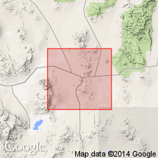
Named as lower member (of 2) of Fraction Tuff. Type locality designated as low slopes south and southeast of Mount Butler and Brock Mountain, secs.11-12 T2N R42E near Tonopah Summit 1.6 km southeast of town of Tonopah, Esmeralda Co, NV. Composed of nonwelded to weakly welded, in part hydrothermally altered vitric-lithic quartz latite to rhyolite ash-flow tuff. Thickness ranges from 60 to 400 m. Unconformably overlies Mizpah Formation; unconformably underlies Siebert Formation, Heller Tuff, King Tonopah Member (new) (Fraction Tuff), and trachyandesite of Red Mountain. Intruded by Oddie Rhyolite; intruded and overlain by Brougher Rhyolite. Is Miocene age based on fission-track age on apatite of 18.4 +/-3.1 Ma and K-Ar age on alkali feldspar of 16.2 +/-0.5 Ma.
Source: GNU records (USGS DDS-6; Menlo GNULEX).
For more information, please contact Nancy Stamm, Geologic Names Committee Secretary.
Asterisk (*) indicates published by U.S. Geological Survey authors.
"No current usage" (†) implies that a name has been abandoned or has fallen into disuse. Former usage and, if known, replacement name given in parentheses ( ).
Slash (/) indicates name conflicts with nomenclatural guidelines (CSN, 1933; ACSN, 1961, 1970; NACSN, 1983, 2005, 2021). May be explained within brackets ([ ]).

