- Usage in publication:
-
- Tonopah rhyolite-dacite*
- Modifications:
-
- Named
- Dominant lithology:
-
- Rhyolite
- Dacite
- AAPG geologic province:
-
- Great Basin province
Summary:
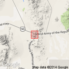
Occupies large part of Tonopah district, central NV. In northern part unit intrudes andesite. In southern part unit contains many inclusions of andesite, vein quartz and granitic fragments. Often intrudes or overlies Fraction dacite breccia. Above Fraction dacite breccia is series of coarse pumiceous tuffs which are rudely layered and rarely well stratified and in which Tonopah rhyolite-dacite sheets are often interbedded, with no sign of intrusion. Occasionally also thin sheets of rhyolite-dacite are found in lower part of overlying Siebert tuffs (lake beds).
Source: GNU records (USGS DDS-6; Menlo GNULEX).
- Usage in publication:
-
- Tonopah dacites
- AAPG geologic province:
-
- Great Basin province
Summary:
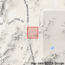
Comparison of analyses of dacites from Tonopah district (Spurr, 1905) with dacite from Goldfield show that although they have different lithologies, they may be approximately equivalent in age.
Source: GNU records (USGS DDS-6; Menlo GNULEX).
- Usage in publication:
-
- Tonopah rhyolite*
- Modifications:
-
- Redescribed
- AAPG geologic province:
-
- Great Basin province
Summary:
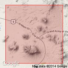
Comparison is made between Spurr's (1905) interpretation and that of Burgess (1909) of the succession of flows. In this report Tonopah rhyolite of Spurr (1905) in north part of area overlies Siebert tuff; Tonopah rhyolite of Spurr (1905) in south part of area underlies Siebert tuff and overlies Fraction dacite breccia.
Source: GNU records (USGS DDS-6; Menlo GNULEX).
- Usage in publication:
-
- Tonopah formation*
- Modifications:
-
- Redescribed
- Revised
- AAPG geologic province:
-
- Great Basin province
Summary:
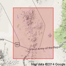
Named Tonopah formation is proposed for what has been previously called "Lower rhyolite" by Burgess (1909). Has also been called "Tonopah rhyolite" or "Tonopah rhyolite-dacite" (Spurr, 1905, 1915) and correlated with rhyolite exposed on surface north of mining district. These exposures have not been studied by writer, but from descriptions they do not appear to be related to beds herein discussed. Rocks of Tonopah formation were previously mapped as "Glassy trachyte" and "Montana breccia" but Tonopah formation does not include all exposures so assigned by Spurr, Burgess, and others. Best exposure is in westerly workings of Tonopah Extension at 1200-, 1540- and 1880-ft levels. Composed of interbedded sequence of volcanic breccias, tuffs, porphyritic and banded flows, and water-laid deposits. In few places underlies West End rhyolite which separates it from Mizpah trachyte. Base not exposed so thickness is probably 1000 ft. Interbedded with Sandgrass andesite. Unconformably underlies Esmeralda ["Siebert"] formation. Age of Tonopah formation is most probably Tertiary and older than late Miocene.
Source: GNU records (USGS DDS-6; Menlo GNULEX).
- Usage in publication:
-
- Tonopah formation*
- Modifications:
-
- Age modified
- AAPG geologic province:
-
- Great Basin province
Summary:
Age may be middle Miocene or early late Miocene based on stratigraphic relations with Esmeralda formation which is strikingly similar in many phases of lithology, implying that their source and conditions of deposition may have been much the same.
Source: GNU records (USGS DDS-6; Menlo GNULEX).
- Usage in publication:
-
- Tonopah Formation*
- Modifications:
-
- Age modified
- AAPG geologic province:
-
- Great Basin province
Summary:
Shown on generalized geologic (and aeromagnetic) map of San Antonio Mountains as occurring east of Liberty Springs and Liberty Mine and south of Cimarron claims; also 5 mi north-northeast of Cimarron claims. Unit includes some dacitic(?) welded tuff. Formation described as oldest Tertiary (of Miocene, probably early Miocene, age) unit in range. Consists of rhyolite and rhyolitic welded ash-flow tuffs commonly altered and locally mineralized. Intruded by dikes of rhyolite porphyry. Underlies Mizpah Trachyte.
Source: GNU records (USGS DDS-6; Menlo GNULEX).
- Usage in publication:
-
- Tonopah Formation
- Modifications:
-
- Overview
- Geochronologic dating
- AAPG geologic province:
-
- Great Basin province
Summary:
Distribution and review of earlier papers included. Formation divided into two informal units which are shown separately on geologic map of Tonopah, Lone Mountain, Klondike, and northern Mud Lake quads, NV. Lower unit is mainly welded, silicic ash-flow tuffs and epiclastic volcanic siltstone and sandstone. Upper unit is made up of rhyolite domes and flows. Fission track ages on zircon of 34.8 +/-4.2 Ma for lower unit and 24.3 +/-2.8 Ma from upper unit were found from samples collected SW/4 sec.24 T3N R42E and NW/4 sec.31 T4N R43E, Nye Co, NV.
Source: GNU records (USGS DDS-6; Menlo GNULEX).
- Usage in publication:
-
- Tonopah Formation*
- Modifications:
-
- Geochronologic dating
- AAPG geologic province:
-
- Great Basin province
Summary:
Tonopah Formation. Sample from ash-flow tuff in NW/4 sec. 31, T. 4 N., R. 43 E., Nye County, Nevada, yielded a fission-track age of 34.8 +/-4.2 Ma (zircon). Sample from flow-banded rhyolite in SE/4 SE/4 SE/4 sec. 1, T. 3 N., R. 42 E., Nye County, Nevada, yielded a fission-track age of 24.3 +/-2.8 Ma (zircon). "The time span between extrusive and intrusive phases seems long (11 m.y.); however, there is no geologic reason to doubt either age." p.13 [Based on DNAG 1983 Geologic Time Scale, age would be Oligocene.]
Source: Modified from GNU records (USGS DDS-6; Menlo GNULEX).
For more information, please contact Nancy Stamm, Geologic Names Committee Secretary.
Asterisk (*) indicates published by U.S. Geological Survey authors.
"No current usage" (†) implies that a name has been abandoned or has fallen into disuse. Former usage and, if known, replacement name given in parentheses ( ).
Slash (/) indicates name conflicts with nomenclatural guidelines (CSN, 1933; ACSN, 1961, 1970; NACSN, 1983, 2005, 2021). May be explained within brackets ([ ]).

