The National Geologic Map Database is migrating to a new infrastructure. We apologize for any service disruptions during this process.
|
|---|


- Usage in publication:
-
- Tongue River coal group*
- Modifications:
-
- Original reference
- Dominant lithology:
-
- Coal
- Shale
- Sandstone
- AAPG geologic province:
-
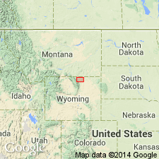
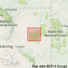
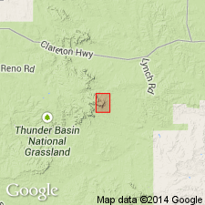
- Powder River basin
Summary:
Pg. 129-130. Tongue River coal group. The coal-bearing rocks of Sheridan coal field, northeastern Wyoming, are divided into 3 coal groups (descending) Ulm coal group, intermediate coal group [=part at least of Sentinel Butte shale member exclusive of Roland coal], and Tongue River coal group. The top bed of Tongue River coal group is Roland coal. It includes also several other coals (Smith, Dietz, Monarch, Carney, and Masters). Is exposed along Tongue River. [Age is Eocene.]
Source: US geologic names lexicon (USGS Bull. 896, p. 2163).
- Usage in publication:
-
- Tongue River member*
- Modifications:
-
- Revised
- AAPG geologic province:
-
- Powder River basin
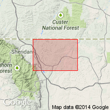
- Williston basin
Summary:
Pg. 484-499. Tongue River member of Fort Union formation. Yellow or light-colored strata containing massive sandstones and numerous thick coal beds. Top of member is placed beneath bed K of Sidney field, bed F of Sentinel Butte field, and Roland coal of Sheridan field. Base is placed beneath the light-colored coal-bearing which characteristically form a marked clinker-capped escarpment rising above lowlands or badlands developed from the somber Lebo shale, with which it intertongues at the contact. According to interpretation of writers the term Fort Union formation should be restricted to Lebo andesitic (or shale) member and Tongue River member, although overlying Sentinel Butte shale is classed as Fort Union(?) by the USGS. The Tongue River member is well exposed along Tongue River between Burns, Montana, and Buford, (Fort Union), North Dakota, also in Missouri Valley above Fort Clark, North Dakota. [Age is Eocene.]
[Recognized in northeastern WY, northeastern, southeastern, and central southern MT, and southwestern SD.]
Source: US geologic names lexicon (USGS Bull. 896, p. 2163).
- Usage in publication:
-
- Tongue River Formation
- Modifications:
-
- Revised
- AAPG geologic province:
-
- Williston basin
Summary:
Revised to include Medora member (new) as a member of the Tongue River Formation of Fort Union Group. Medora is a tabular sand body, 15-25 ft thick, lying 80 ft below top of Tongue River Formation at Medora, ND. Area of study for this report is in Billings, Slope, and Adams Cos, ND, in the Williston basin. Four basic lithologic types present in the Tongue River are: 1) gray clay and silt, commonly lignitic; 2) lignite; 3) yellow silt and sand which may be clayey; and 4) sand. Of Paleocene age.
Source: GNU records (USGS DDS-6; Denver GNULEX).
- Usage in publication:
-
- Tongue River Formation
- Modifications:
-
- Not used
Summary:
Strata in the Fort Union Group above the Cannonball Formation to the top of the white marker zone named Slope Formation of Fort Union Group. Strata above the white marker to the base of the drab Sentinel Butte Formation named Bullion Creek Formation of Fort Union Group. Rocks assigned to the Slope and Bullion Creek were considered Tongue River Formation in earlier reports. No one set of criteria was used to distinguish Tongue River in the earlier reports. Term Tongue River not used.
Source: GNU records (USGS DDS-6; Denver GNULEX).
- Usage in publication:
-
- Tongue River Member
- Modifications:
-
- Not used
Summary:
In the Reno Junction-Antelope Creek area--Campbell, Converse, Niobrara, and Weston Cos, WY in the southern Powder River basin--the Fort Union comprises the Tullock and overlying Lebo Members. Tongue River Member is not used in this area. Lebo Member of study area is said to be equivalent to Lebo and overlying Tongue River Members of the Fort Union in northern part of Powder River basin. Age not stated.
Source: GNU records (USGS DDS-6; Denver GNULEX).
- Usage in publication:
-
- Tongue River Member*
- Modifications:
-
- Biostratigraphic dating
- AAPG geologic province:
-
- Powder River basin
Summary:
Is top member of Fort Union Formation in northwestern Powder River basin, Big Horn Co, MT. Overlies Lebo Shale Member of Fort Union. Underlies Wasatch Formation (Eocene). Fossils collected from about 50 m above base of member in 0.6 m thick, yellowish-gray, sandy conglomerate that is interpreted to be a channel-lag deposit. Fossil fauna includes fish, turtles, crocodiles, and mammals. Mammalian genera known from rocks of both the Torrejonian and the Tiffanian land mammal ages (middle and late Paleocene) are present; but evolutionary stage of APHRONORUS and mutual presence of NANNODECTES and a primitive species of ECTOCION suggest a Tiffanian (late Paleocene) age for deposit. Fossil-bearing unit at USGS D-2003 (Newell's Nook), 48 km east of Hardin, MT, at about same stratigraphic horizon as lowest coal bed in Tongue River Member--thus dating (faunally) initiation of major Paleocene coal accumulation in northwestern Powder River basin.
Source: GNU records (USGS DDS-6; Denver GNULEX).
- Usage in publication:
-
- Tongue River Member*
- Modifications:
-
- Revised
- AAPG geologic province:
-
- Powder River basin
Summary:
Is top member of Fort Union Formation in northwestern Powder River basin. Is mapped with underlying Lebo Shale Member of Fort Union in Sheridan and Campbell Cos, WY and Powder River Co, MT. Conformably overlies Lebo; unconformably underlies Wasatch Formation (revised). Tongue River is distinguished from Wasatch on basis of: 1) sandstone is finer grained and better sorted than that of Wasatch; 2) varies from light gray to somber shades of gray, while Wasatch characteristically weathers buff to tan; 3) brown-weathering, calcareous, iron-rich, cauliflower shaped concretions (less than an inch to as large as 4 ft) are most common in the Fort Union, and are generally absent from the Wasatch; 4) dominant heavy minerals in the Fort Union (Lebo and Tongue River) are tourmaline and a pinkish-violet variety of zircon in contrast to sphene, epidote, and garnet in the Wasatch; and 5) minor accessory minerals in the Fort Union are chloritoid, staurolite, and rutile compared to apatite, epidote, and biotite in the Wasatch. For purposes of this map (and others in same series) the upper contact of the Tongue River is revised downward 200-300 ft from that of most previous workers in the basin. Strata below the top of Baker's (1929) Roland coal bed are referred to as lower part of Wasatch instead of upper part of Tongue River. Combined thickness of Lebo and Tongue River is 2,150-4,150 ft. Age given as Paleocene.
Source: GNU records (USGS DDS-6; Denver GNULEX).
- Usage in publication:
-
- Tongue River Member*
- Modifications:
-
- Areal extent
- AAPG geologic province:
-
- Powder River basin
Summary:
Is top member (of 3) of Fort Union Formation in southeastern Powder River basin, Campbell Co, WY. Overlies Lebo Shale Member of Fort Union; underlies Wasatch Formation. Formerly included in Lebo Shale Member by Denson and others (1980), this sandy, coal-bearing upper part of Fort Union in Piney Canyon SE quad is considered correlative with Tongue River Member of Fort Union of adjacent areas. Study shows 298-646 ft of Tongue River present below clinker bed of upper Wyodak coal bed in this area. Consists of sandstone (2 types distinguished), mudrock (interbedded siltstone, mudstone, claystone and shale), carbonaceous shale, coal, and ironstone concretions. Detailed lithologic descriptions and columnar sections presented. Stratigraphic interval divided into 5 lithologic complexes: 1) lower mudrock-dominated; 2) lower sandstone-dominated; 3) middle mudrock-dominated; 4) upper sandstone-dominated; and 5) upper mudrock-dominated. Four facies are described with interpreted environment of deposition: 1) channel facies (type I sandstone); 2) overbank sandstone facies (type II sandstone); 3) floodplain facies (primarily mudrock with common ironstone concretions); and 4) swamp facies (carbonaceous shale and coal). Age is late Paleocene.
Source: GNU records (USGS DDS-6; Denver GNULEX).
For more information, please contact Nancy Stamm, Geologic Names Committee Secretary.
Asterisk (*) indicates published by U.S. Geological Survey authors.
"No current usage" (†) implies that a name has been abandoned or has fallen into disuse. Former usage and, if known, replacement name given in parentheses ( ).
Slash (/) indicates name conflicts with nomenclatural guidelines (CSN, 1933; ACSN, 1961, 1970; NACSN, 1983, 2005, 2021). May be explained within brackets ([ ]).