The National Geologic Map Database is migrating to a new infrastructure. We apologize for any service disruptions during this process.
|
|---|


- Usage in publication:
-
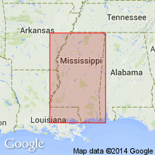
- Tombigbee sand group
- Modifications:
-
- Named
- Dominant lithology:
-
- Sand
- AAPG geologic province:
-
- Warrior basin
Summary:
Named for exposures on Tombigbee River near Aberdeen, Monroe Co. and at Plymouth Bluff, Lowndes Co., MS. Consists of sharp fine-grained, strongly micaceous fossiliferous sands, laminated when indurate, and cemented by carbonate; usually greenish tint, but not infrequently gray, bluish, black, yellowish, and sometimes orange red. Clays and noncalcareous, also nonmicaceous, sands are also found. The Tombigbee is 150-160 ft thick. It underlies the Rotten limestone group (Selma chalk); overlies Eutaw Group.
Source: GNU records (USGS DDS-6; Reston GNULEX).
- Usage in publication:
-
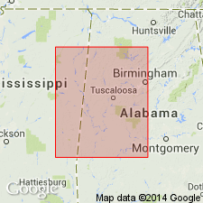
- Tombigbee Sand Member*
- Modifications:
-
- Age modified
- AAPG geologic province:
-
- Black Warrior basin
Summary:
In Mississippi the Austinian-Tayloran boundary occurs within the Mooreville Formation approximately 21 plus or minus 6 m above the Santonian-Campanian boundary. In Alabama the Santonian-Campanian boundary occurs within the Mooreville, approximately 35 m above the Eutaw-Mooreville contact, and the Austinian-Tayloran boundary occurs within the Mooreville approximately 36.5 m above the Santonian-Campanian boundary. The Arcola Limestone Member of the Mooreville, previously used to designate the Austinian-Tayloran boundary, lies well within the Tayloran Stage. In eastern Mississippi the Santonian-Campanian boundary occurs within the Tombigbee Sand Member of the Eutaw Formation.
Source: GNU records (USGS DDS-6; Reston GNULEX).

- Usage in publication:
-
- Tombigbee Sand
- Modifications:
-
- Overview
- AAPG geologic province:
-
- Black Warrior basin
Summary:
Tombigbee has been considered a member of the Eutaw Formation since Stephenson (1911). Though the two are without a doubt closely related, the Tombigbee is a lithologically distinct, mappable unit and it is frequently very fossiliferous while the typical Eutaw is not. It was deposited in a quiet zone transitional to shelf muds unlike the lower Eutaw, which was deposited in shallow, high-energy near-shore waters. Author suggests that perhaps the Tombigbee should be removed from the Eutaw.
Source: GNU records (USGS DDS-6; Reston GNULEX).
- Usage in publication:
-
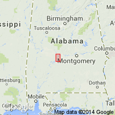
- Tombigbee Sand Member
- Modifications:
-
- Biostratigraphic dating
- AAPG geologic province:
-
- Mid-Gulf Coast basin
Summary:
In a composite reference section established in this report in Dallas Co., central AL, along the Alabama and Cahaba Rivers, the Tombigbee Sand Member of the Eutaw Formation and the lower 104 ft of the Mooreville Chalk are of late Santonian age as defined by the presence of DICARINELLA ASYMETRICA. The interval from 104 ft above the base of the Mooreville to 265 ft above the base of the Demopolis Chalk is assigned to the GLOBOTRUNCANITA ELEVATA Interval Zone of early to late Campanian age. The upper 95 ft of the Demopolis Chalk and the lower 50 ft of the Ripley Formation are assigned to the G. TRICARINATA Interval zone (early Maastrichtian). The ages of the stratigraphic units defined herein on the basis of a composite reference section in central AL using planktonic Foraminifera and ostracodes agree well with previous studies using calcareous microfossils. However, the ages of the units as published by King and Skotnicki (1992) and King (1993) are not based on any biostratigraphic or chronostratigraphic data and are suspect.
Source: GNU records (USGS DDS-6; Reston GNULEX).
For more information, please contact Nancy Stamm, Geologic Names Committee Secretary.
Asterisk (*) indicates published by U.S. Geological Survey authors.
"No current usage" (†) implies that a name has been abandoned or has fallen into disuse. Former usage and, if known, replacement name given in parentheses ( ).
Slash (/) indicates name conflicts with nomenclatural guidelines (CSN, 1933; ACSN, 1961, 1970; NACSN, 1983, 2005, 2021). May be explained within brackets ([ ]).