- Usage in publication:
-
- Tolman Hill member
- Modifications:
-
- First used
- Biostratigraphic dating
- Dominant lithology:
-
- Volcanics
- Rhyolite
- Rhyodacite
- AAPG geologic province:
-
- New England province
Summary:
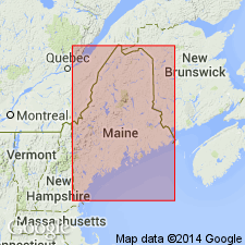
Three members of the Stetson Mountain Formation [new name] in the Danforth quad are recognized and are here named the Tolman Hill, Ironstone, and Public Lot Ridge members. Tolman Hill consists almost entirely of brittle, extremely hard, chalky white weathering, greenish gray cryptocrystalline volcanic rock. Underlies Owl Mountain and Stetson Mountain in the Danforth quad, and parts of Bowers Mountain and Tolman Hill in the Springfield quad. Also underlies Baker, Bennett, and Howard ridges in the Danforth quad. Chemical analyses show that rocks are rhyolites and rhyodacites. Caradocian age based on graptolites.
Source: GNU records (USGS DDS-6; Reston GNULEX).
For more information, please contact Nancy Stamm, Geologic Names Committee Secretary.
Asterisk (*) indicates published by U.S. Geological Survey authors.
"No current usage" (†) implies that a name has been abandoned or has fallen into disuse. Former usage and, if known, replacement name given in parentheses ( ).
Slash (/) indicates name conflicts with nomenclatural guidelines (CSN, 1933; ACSN, 1961, 1970; NACSN, 1983, 2005, 2021). May be explained within brackets ([ ]).

