

- Usage in publication:
-
- Tiser Limestone
- Modifications:
-
- Original reference
- Biostratigraphic dating
- Dominant lithology:
-
- Limestone
- AAPG geologic province:
-
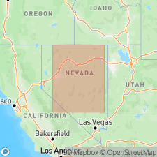
- Great Basin province
Summary:
Pg. 2696. Tiser Limestone. Pale-blue, fine-grained, medium-bedded limestone with chert stringers and nodules, and shale beds. Thickness 27 m at type; ranges from 27 to 46 m. Gradationally overlies Valder Formation; underlies Noh Formation. Age is Middle Ordovician, [based on fossils (graptolites, brachiopods, trilobites)].
Source: US geologic names lexicon (USGS Bull. 1520, p. 309); supplemental information from GNU records (USGS DDS-6; Menlo GNULEX).
- Usage in publication:
-
- Tiser Limestone*
- Modifications:
-
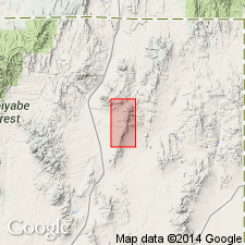
- Areal extent
- AAPG geologic province:
-
- Great Basin province
Summary:
Pg. 3 (column 14), App. p. 23. Tiser Limestone of Riva (1970). Thin limestone occurring locally in one structural plate in the HD Range, Elko Co., northeastern NV. Lies below Agort Chert; = part of Vinini Formation. Age is Middle Ordovician.
[HD Range unlabeled on topographic maps; occurs btw. Lat. 41 deg. 37 min. 31 sec. N. and 41 deg. 29 min. 59 sec. N., Long. 114 deg. 37 min. 34 sec. W. and 114 deg. 30 min. 04 sec. W., in Knoll Mountain SE, Texas Spring, Blanchard Mountain, Knoll Mountain, and Wine Cup Ranch 7.5-min quadrangles, Elko Co., northeastern NV (USGS GNIS database, accessed June 25, 2014).]
Source: Publication; supplemental information from K.B. Ketner, USGS (written commun., 2010).
For more information, please contact Nancy Stamm, Geologic Names Committee Secretary.
Asterisk (*) indicates published by U.S. Geological Survey authors.
"No current usage" (†) implies that a name has been abandoned or has fallen into disuse. Former usage and, if known, replacement name given in parentheses ( ).
Slash (/) indicates name conflicts with nomenclatural guidelines (CSN, 1933; ACSN, 1961, 1970; NACSN, 1983, 2005, 2021). May be explained within brackets ([ ]).